Thursday, July 29
Good morning sunshine – I packed up and soon reached Olot, a colorful town, hosting both Renaissance and Art Nouveau architecture.

It had a nice pedestrian zone, where I had a nice breakfast at one of the cafés. It was quite early on a weekday and was deserted.

Leaving town, the road started inclining and I started the first major climb on this trip, definitely not the last one... It was a hot day, was quite grueling, but the scenery was worth it.

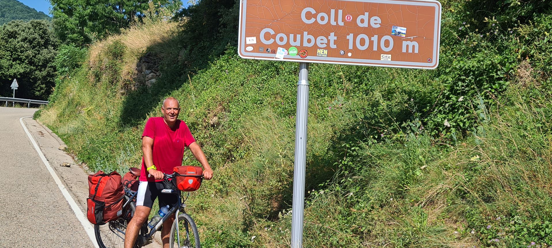
I eventually reached the first summit, called Coll de Coubet, at 1,010 meters, meeting some other bikers.
There I found a restaurant with a wonderful viewing deck of the higher ranges of Pyrenees – the only issue was that it was closed due to renovation, but after some negotiation (see my skills?) with the workers, I was allowed to sit there and enjoy the views.

Some downhill, then more climbing – and got to the next summit, Coll de Santigosa at 1,064 meters.

These were just the first two of the many more inclines to come. What goes up, must come down – and after some downhill cruising got to another nice town, called Sant Joan de les Abadesses, with a monastery, ancient stone bridges over the River Ter and fortifications. I wanted to visit the monastery, which was founded in the 9th century, but would have had to wait two hours or so for it to open, well, Spain loves its siestas.


Having left town, quite an incline started On the way there, the scenery resembled very much the Austrian Alps, lush green vegetation on the lower ranges, somewhat barren at the summits. Hmmm, one of the towns on the opposite side of the summit was called “Alp”, is that a coincidence? Traffic was really light, still, the going was tough.

I reached the pass, called Collada de Toses at 1,790 meters above sea level, only around 7 pm.

Right after the summit, there was a skiing area called Roc Blanc, at this time of the year, it was anything but blanc, Spanish for white - it being all green. There was a 4* hotel, where I would have loved to stay – only that they were fully booked, so I started looking for a wild-camping site. On a side road, I found a helicopter landing area, a perfect spot with wonderful views of the surroundings. I was quite beat for the day, hoped not to encounter any wild animals – which I did not – and dozed off for the day.

Here you can see the trip in Google Maps, it was 82 kilometers, with roughly 1,900 meters of elevation of climbing and 635 meters of descent.