Biking Day 5
- Length ridden: 80 km
- Ascent: 1,950 meters
- Rating: 7.5 out of 10 - nice pass, weather so-so
- Highlights: Making it to the pass, getting a safe place to sleep in the thunder
- Lowlight: Could have had better weather, for sure
- Map of the day
It was not until 8:30 that I had left, prior to that I was served a not-so-luxury breakfast by a Portugiese lady not speaking ay other language than Portugiese.
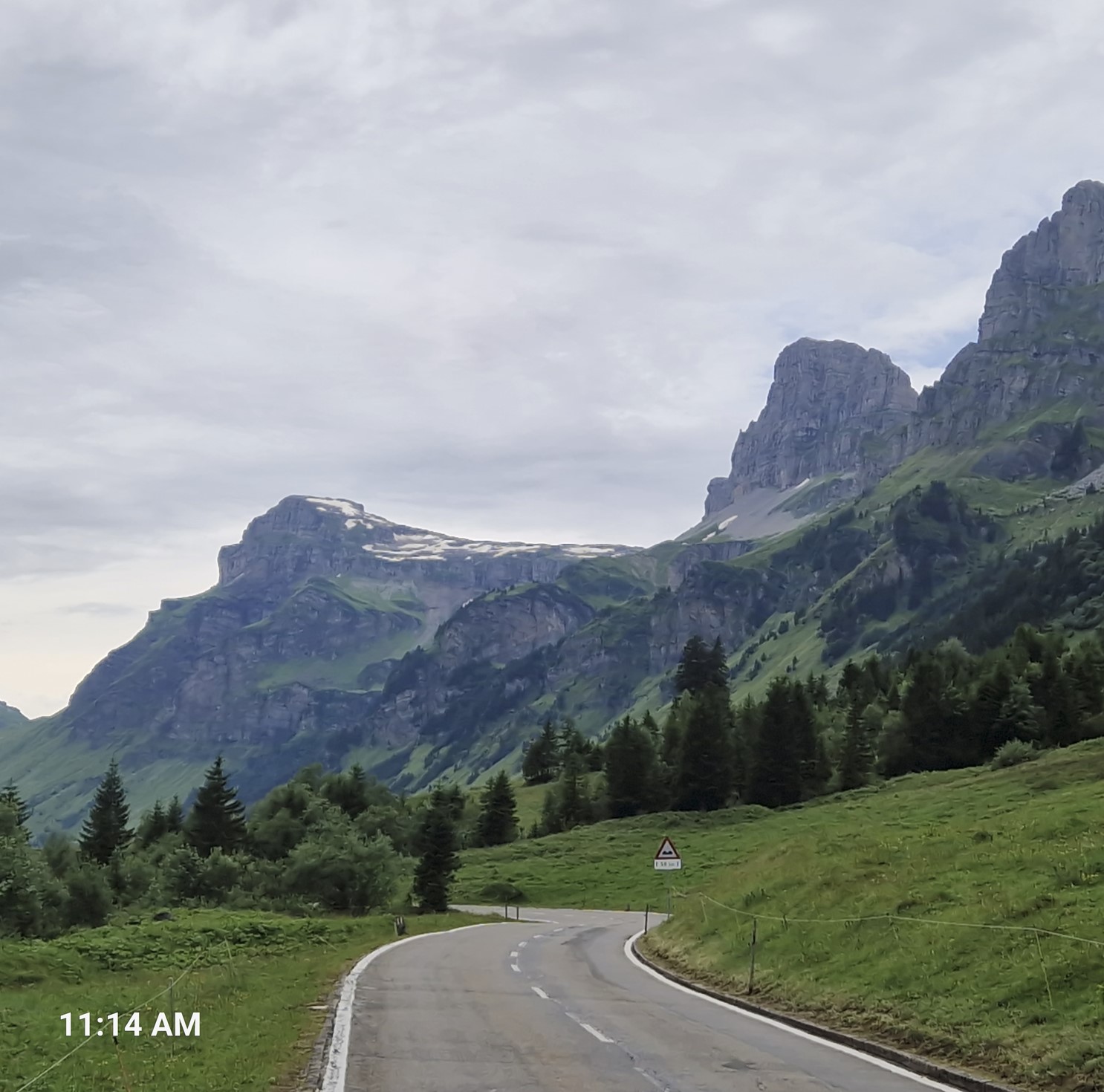
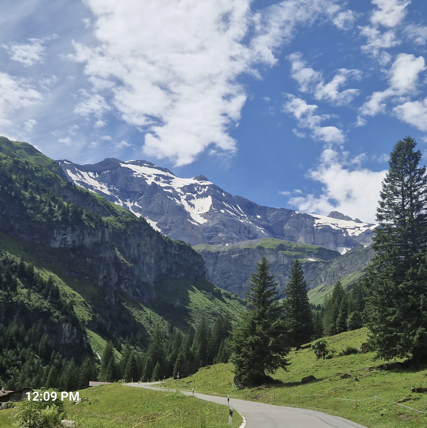
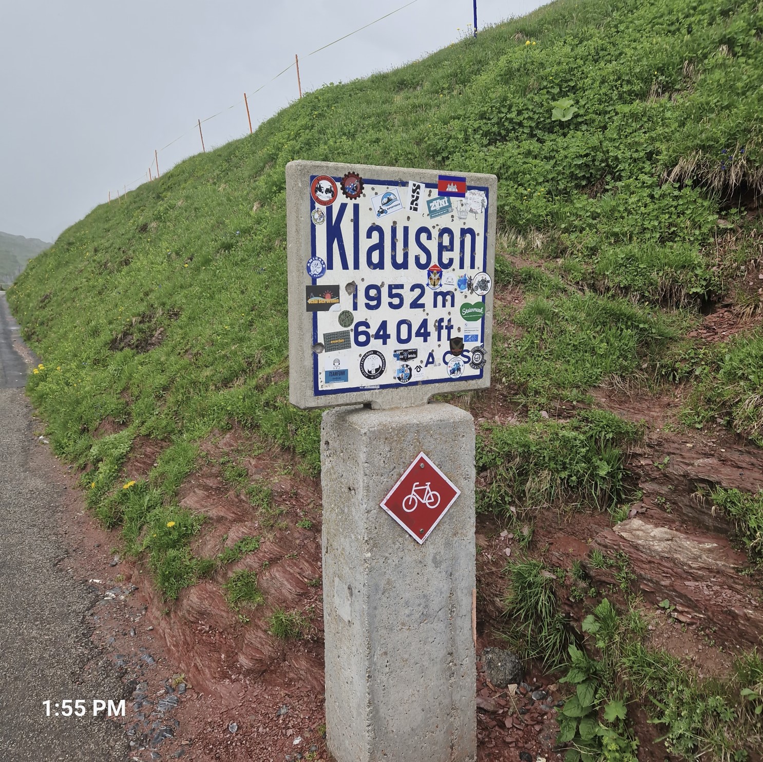
The weather was quite OK, it was not uninterrupted sunshine, but it wasn`t raining either. It was a long ascent ahead of me, I was heading up to a pass called Klausen Pass. Let me show you how pretty the road was.
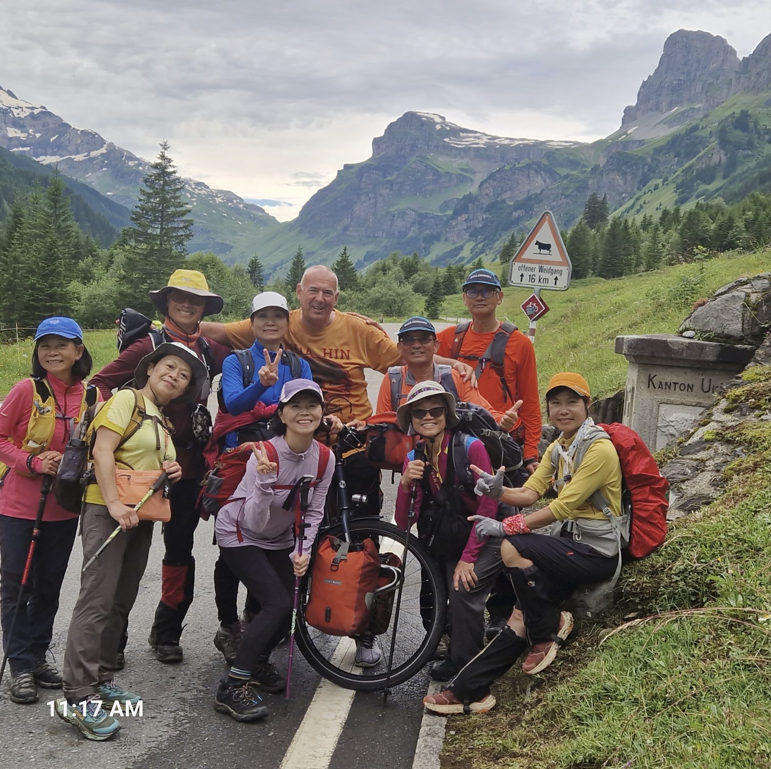
I stopped to take a photo between the Cantons Glarus and Uri and all of a sudden, out of nowhere, a group of Taiwanese hikers showed up.
At an Alm, I bought some cheese, the price of which was not too bad, plus it was tasty (well, better than a slice of sluggish pizza for CHF 8,50). I was dressed up warmly, just before the final ascent for the pass, I decided to strip down to shorts and sandals.
Finally, I had managed to reach the summit, where I again had to put on my warm clothes.
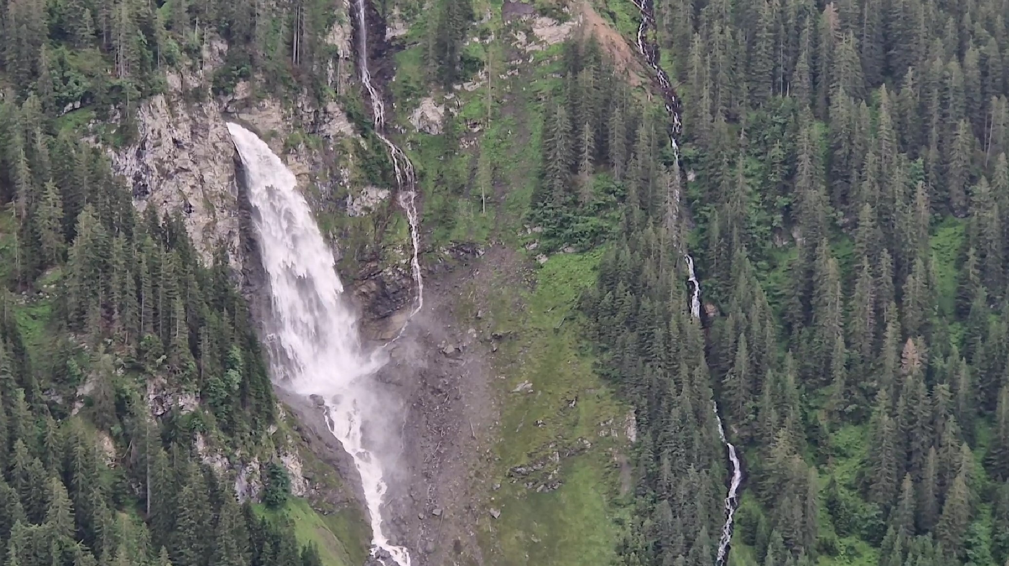
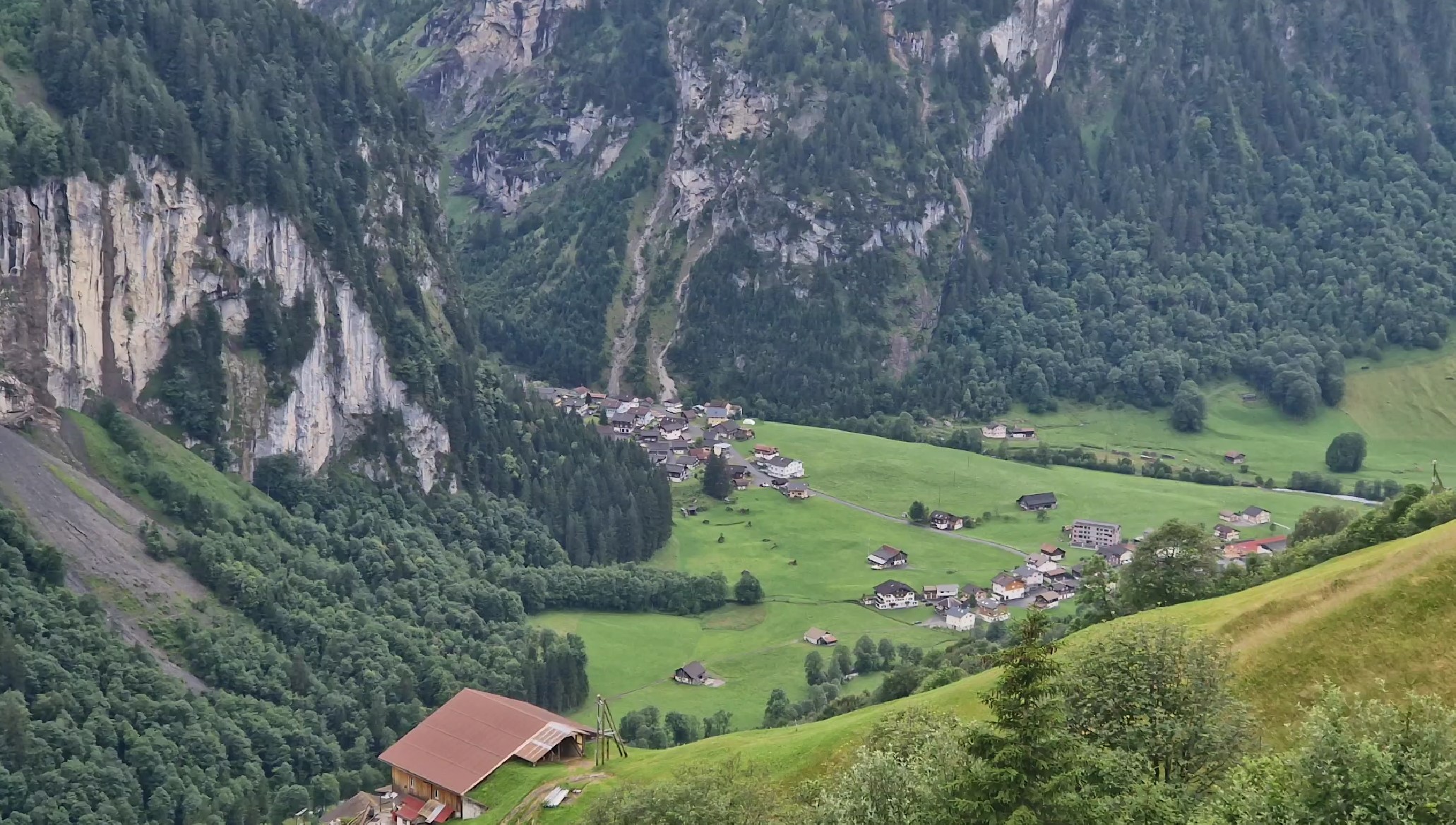
It was rather cold on the way down, but nothing too bad. I saw some majestic waterfalls, with the water roaring down the mountainside and crushing on the hills below. In the narrow valley below, one could see small villages tucked between the mountains.
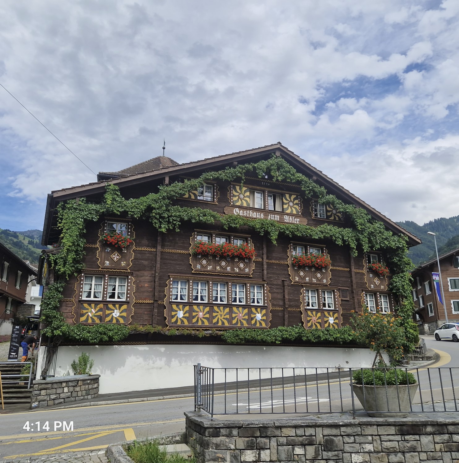
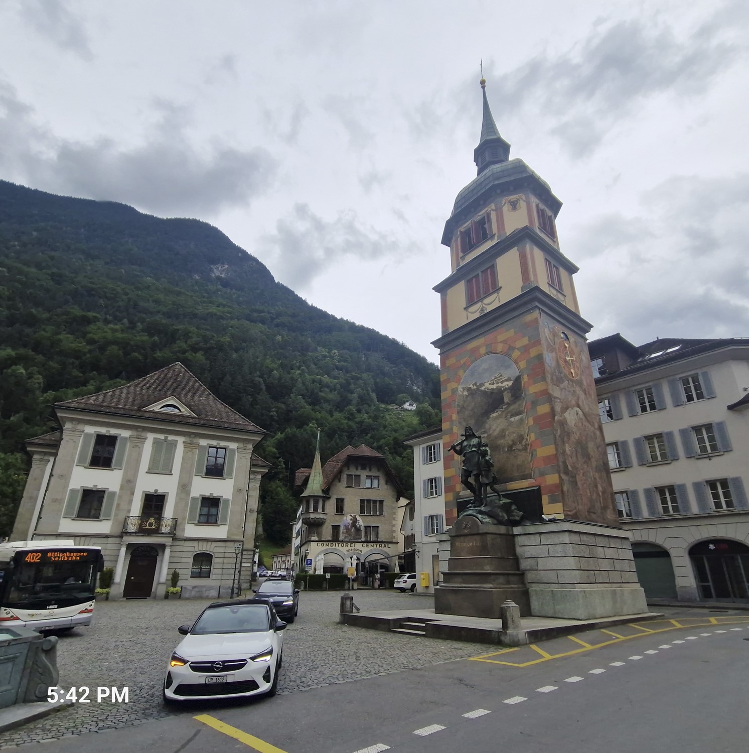
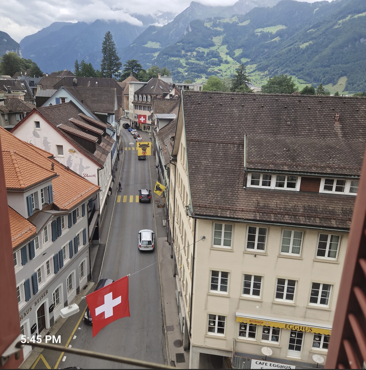
Nearing the valley, I was in for a joy ride, seeing one historic wooden building after the other. It was then that I reached the village of Bürglen, the birthplace of Wilhelm Tell.
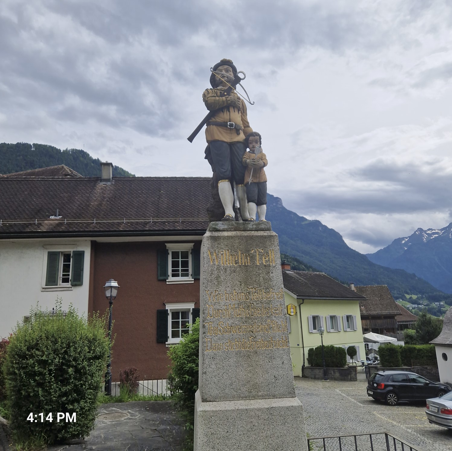
Soon thereafter I got to Altdorf, which is one of the central places called the "Cradle of Switzerland". According to legends and myths, to which the story of Wilhelm Tell belong, this is where the origins of today´s Switzerland were laid down. A funny detail - at first, I did not know what the "Cradle of Switzerland" is, but now I do - an elderly lady, who was from there, also had no idea...
It was on the afternoon of this day that I agreed with my friend Karin that she would take a bus from Vienna to Geneva, to meet not only me, but also her daughter Sarah, who would be arriving to Geneve from her vacation in Spain and France, on the way back to Vienna. She made me promise to reach Geneva by the evening of July 16 - with the intention of picking up Sarah at the train station arriving in the morning of the following day. This way, the three of us could spend a day together touring the city. So my plan was now to reach Geneva in the westernmost portion of Switzerland by the following Tuesday, so I had four full days to figure out how to get there.
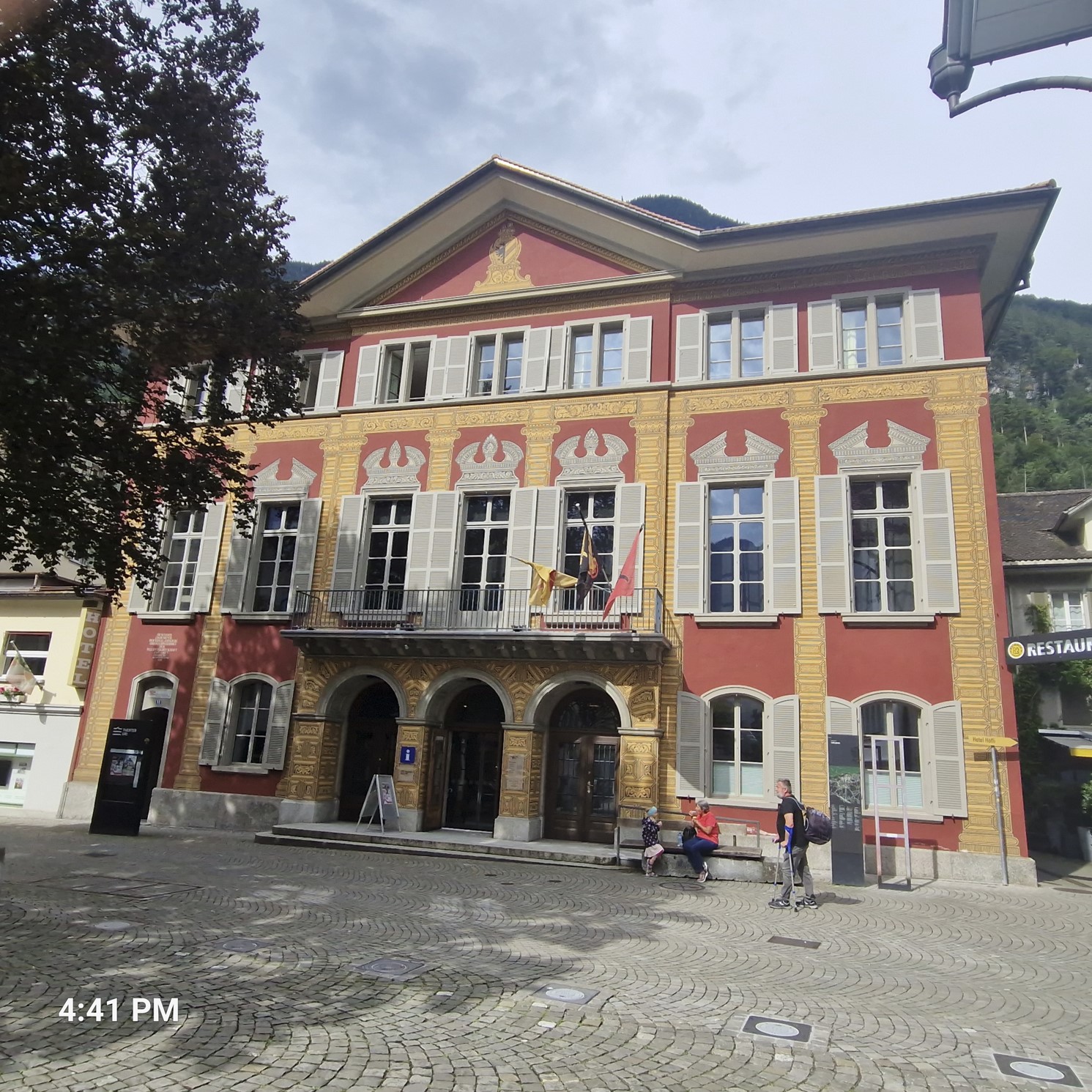
I discussed my options at the tourist office (which is displayed on the third picture above), I got good tips as to where to go next, and they had a good recommendation to get the most out of Switzerland and be able to arrive in Geneva in time. The young lady was very helpful and I think I got like seven different maps. Of course, I could always be hit by some technical issues, my bike could be stolen or I could fall ill - it was impossible to give a biding confirmation to Karin, but it was very in the realm of possibilities to make it there.
As for the immediate step getting out of Altdorf, I turned to a southern heading , my plan being to take the Susten Pass the following day. I already had quite a few meters of altitude in my feet that day and after a while of riding on a flat area, the road started ascending - with even a sign indicating this. In Switzerland, you get an indication at the beginning of pass roads, saying e.g. "this road will go up 1,800 meters in the next 20 kilometers", or something similar. So seeing this sign, I was a bit appalled, especially it having been a Friday evening, with either no rooms available for the upcoming weekend or if there was a vacancy, it would be at a very high price. As far as I could see, there were no campsites around. Worse, sure signs of a major downpour were beginning to show.
This is when I spotted a sort of a parking for camping cars next to the road, called Stellplatz an der Reuss, right next to the river Reuss. There was a sign saying no tents allowed. There were a couple of people drinking heavily in a bar called Hillbilly Pub, quite a funny name. I asked one of the "hillbillies" (who turned out to be much nicer than I had anticipated) if I might still pitch my tent as an exception, hoping for the best. They talked to each other in Schwyzerdütsch, of which I understood absolutely nothing, when, to my surprise, one of them stood up and asked me to follow him. He explained they did not have a shower, but there was a shed with a plastic canopy cover and I could sleep beneath it there. It was a great decision - and the gods were on my side. As soon as I had pitched my tent and brushed my teeth, the huge downpour indeed had started, but I was well protected under the canopy. Oh my, without it, I would probably have gotten soaking wet. I dozed off listening to the sound of thunder.
I rode about 80 kilometers that day.