Biking Day 31
- Length ridden: 100 km
- Ascent: 400 meters
- Rating: 9 out of 10 - a bit of deduction for the difficult crossing
- Highlights: Saint Cado was a hit and Aurey was wonderful
- Lowlight: Better websites for ferry crossing - and getting my bike full of sand
- Map of the day till the ferry
- Map of the day from the ferry
A little after 7:30, I was all packed up, did some basic cleaning, then was on the road. I made it back to "civilization" with hardly any signs of life at that early hour. I did meet a lady walking her dog (no, it did not attack me), she assured me that a ferry would already be running over the inlet that was in front of me. I arrived to Le Maguoer, which settlement is noteworthy as I did not find a single mention about it on the internet, and I searched for a few minutes, I give up. Here is some basic info, it does exist, but does not say more. There were signs of a ferry, but I had no information as to when it was running, so what else to do, I rode around the inlet, backtracking a bit. It was a scenic area around the bridge in the fresh, crisp morning.
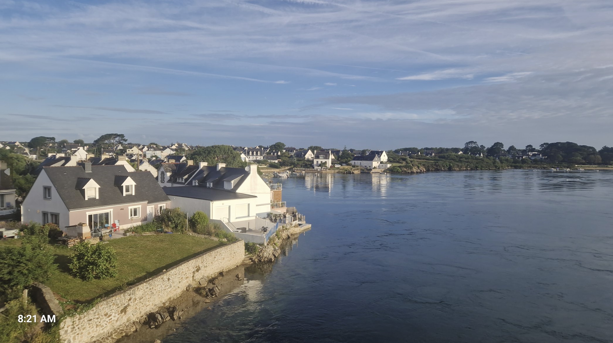
Reaching the the other side, there was an Aldi supermarket, which was just opening up for the day. I bought some pastries, orange juice and some yoghurt and put out my tent for it to dry, as it got quite damp during the night.
Then I spotted a brown sign indicating that "Saint Cado" was a couple of kilometers away. I hesitated for a while - I believe I have already told you why - a brown side means a) a detour b) it is where I tend to "lose" precious time, which I could easily dedicate to riding - but then I was in no special hurry or stress and the brown signs were usually lead to very nice places, so I went to check out Saint Cado.
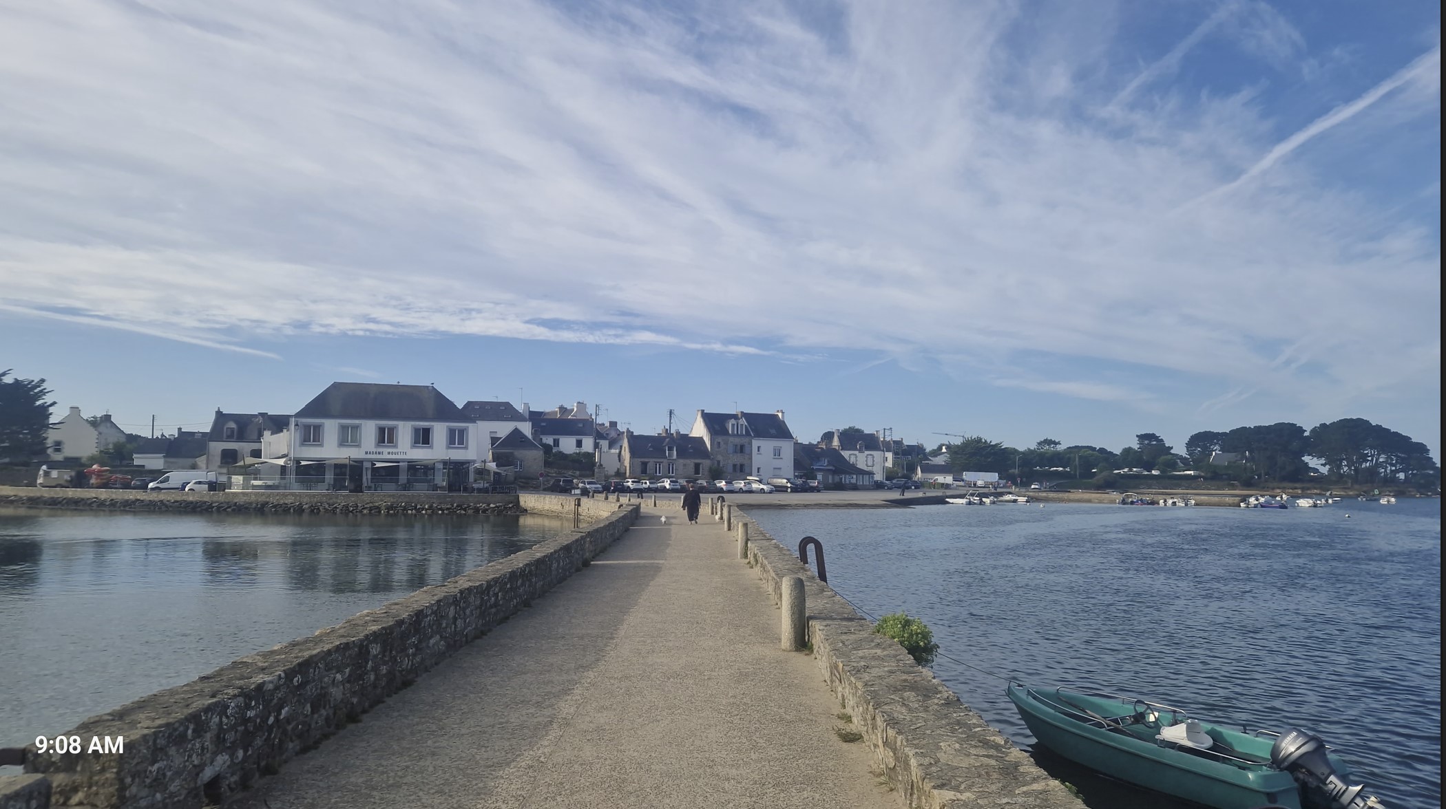
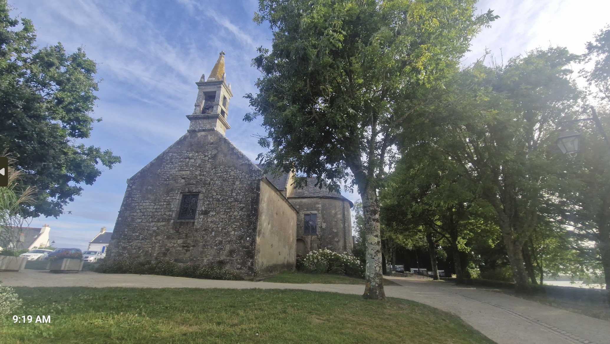
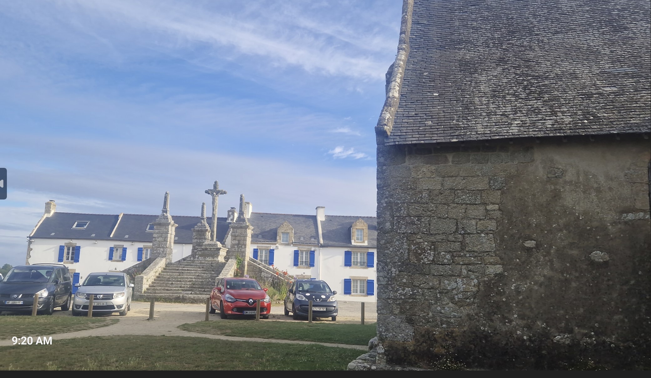
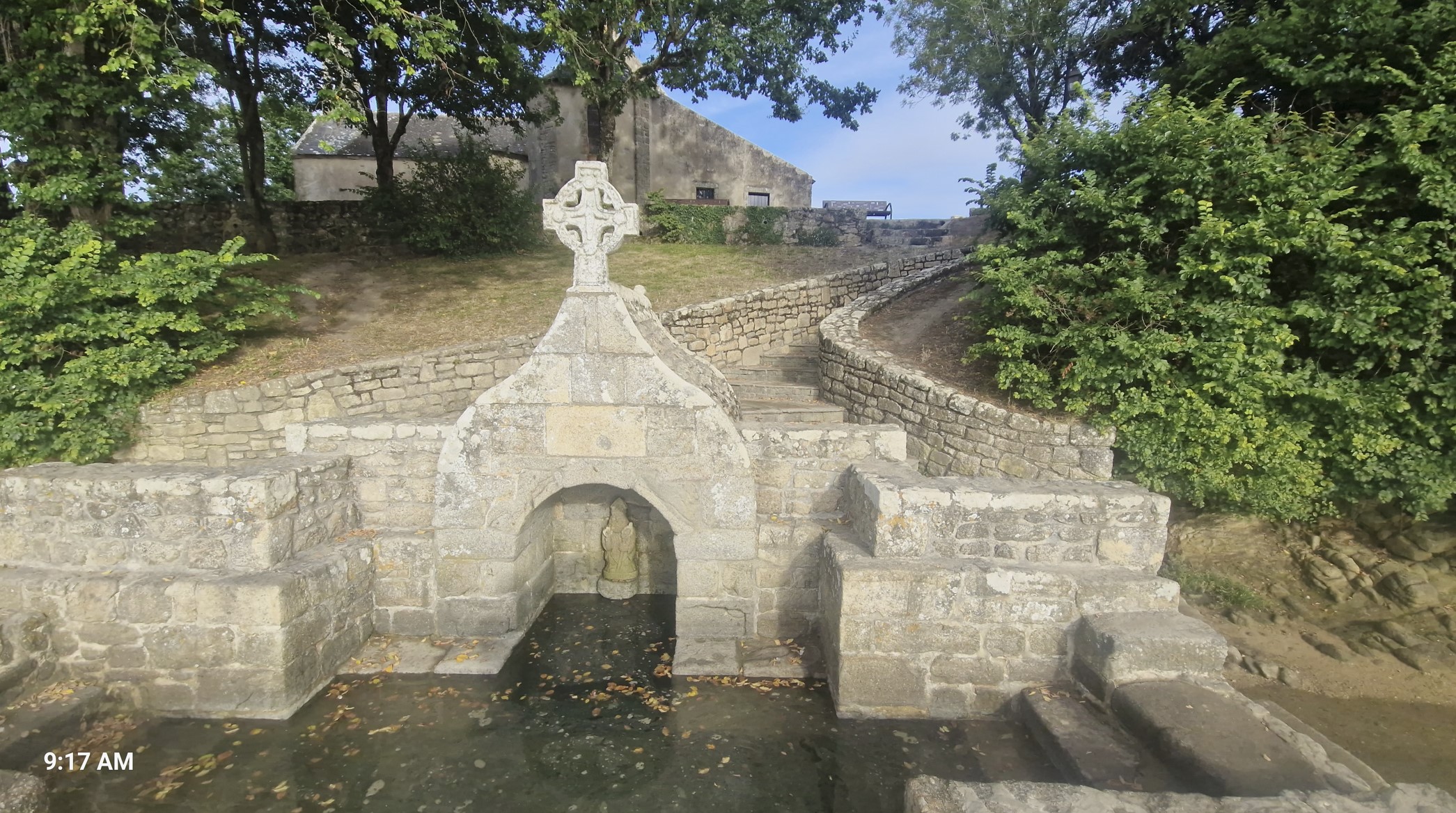
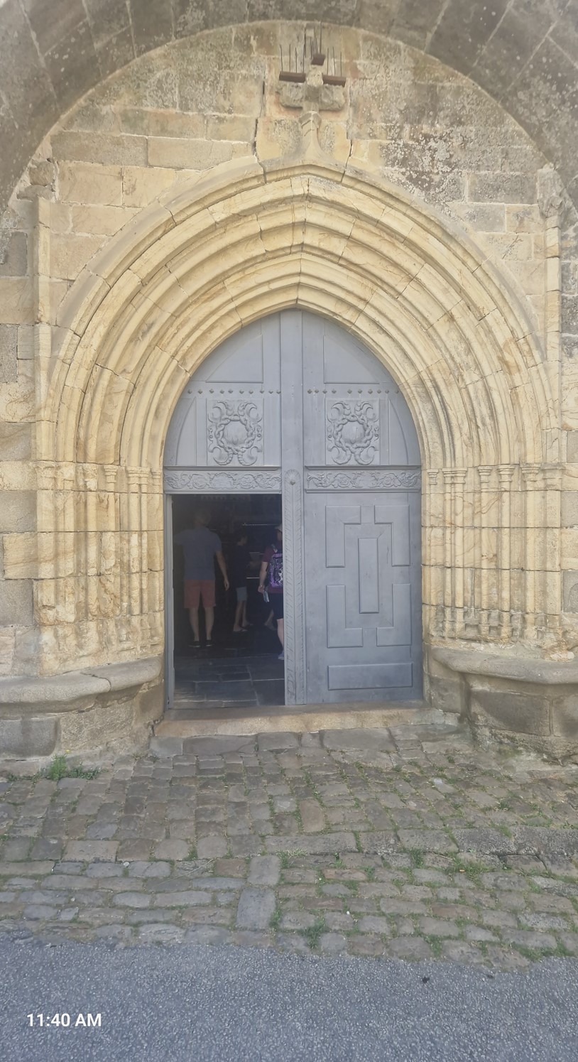
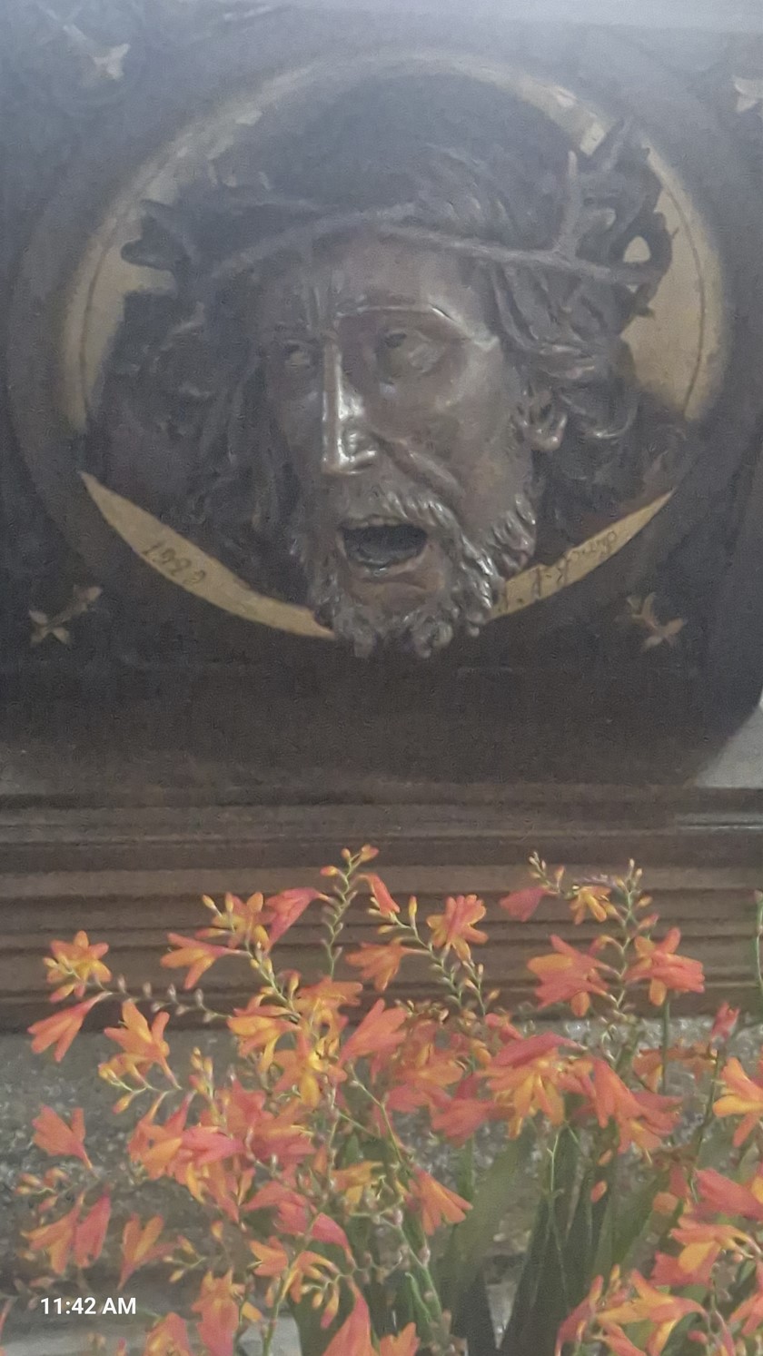
...and what a good decision it was! First Saint Cado was in Belz, all very simple, one-sylabble places, without weird accents going in all sorts of different direction, so easy to search over the net and write about. Belz is a small island, also called an islet (ha! I did not know this word till googling it up till now) connected by a stone bridge to the mainland. There is a Romanesque chapel dedicated to Saint Cado that was built by monks in the 12th century, in front of which is a calvary decorated with sculptures - and also a fountain which regularly get submerged at high tide.
Legend has it that the Saint Cado wanted a bridge to connect the island separated from the land, but lacked the means. One day, he received a visit from the Satan, who offered his help on condition that he would be granted the soul of the first living being to pass over this bridge. Saint-Cado accepted and the Demon created the stone structure in just one night. In the early morning, Saint Cado encouraged a cat to cross the bridge. Satan was not expecting this, but this is exactly what had happened.
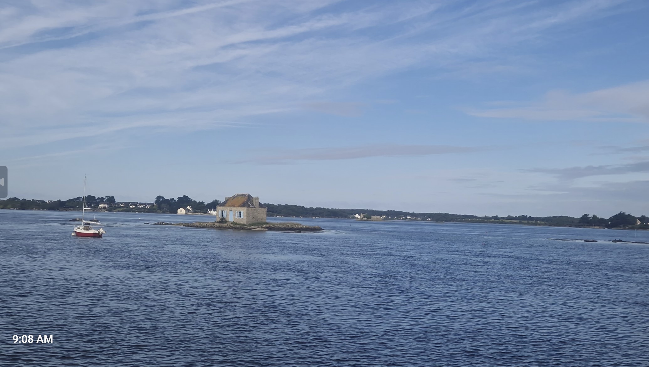
Even before reaching the islet, I spotted a small house with blue shutters set on the rocky islet. It is also known as the oyster house, as it was once the home of an oyster park keeper and his family. Currently uninhabited, this house invites you to dream about staying there forever.
Let me show you the stone bridge, the chapel, the calvary and the fountain.
There was a path and I went for a walk, which lasted not more than 15 minutes, around the islet, with beautiful views of the water between oyster farms, forests and small coves where colorful boats sail. Also to be seen were photographs, as to how the little village looked a century ago.
There was something truly magical about this place.
Not long thereafter, I stopped at a wonderful patisserie called Kerjean, where I bought some tasty Queen-Anne`s, or whatever the most fatty pasty in Europe is called, Amman Quigin, who can remember that.
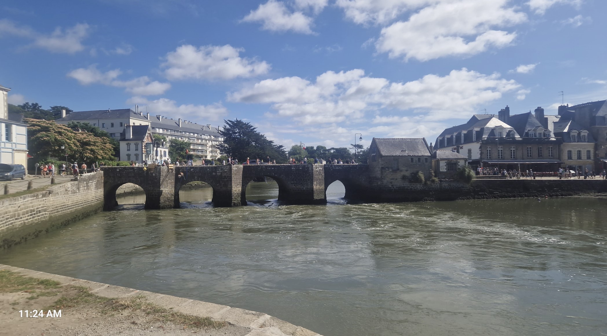
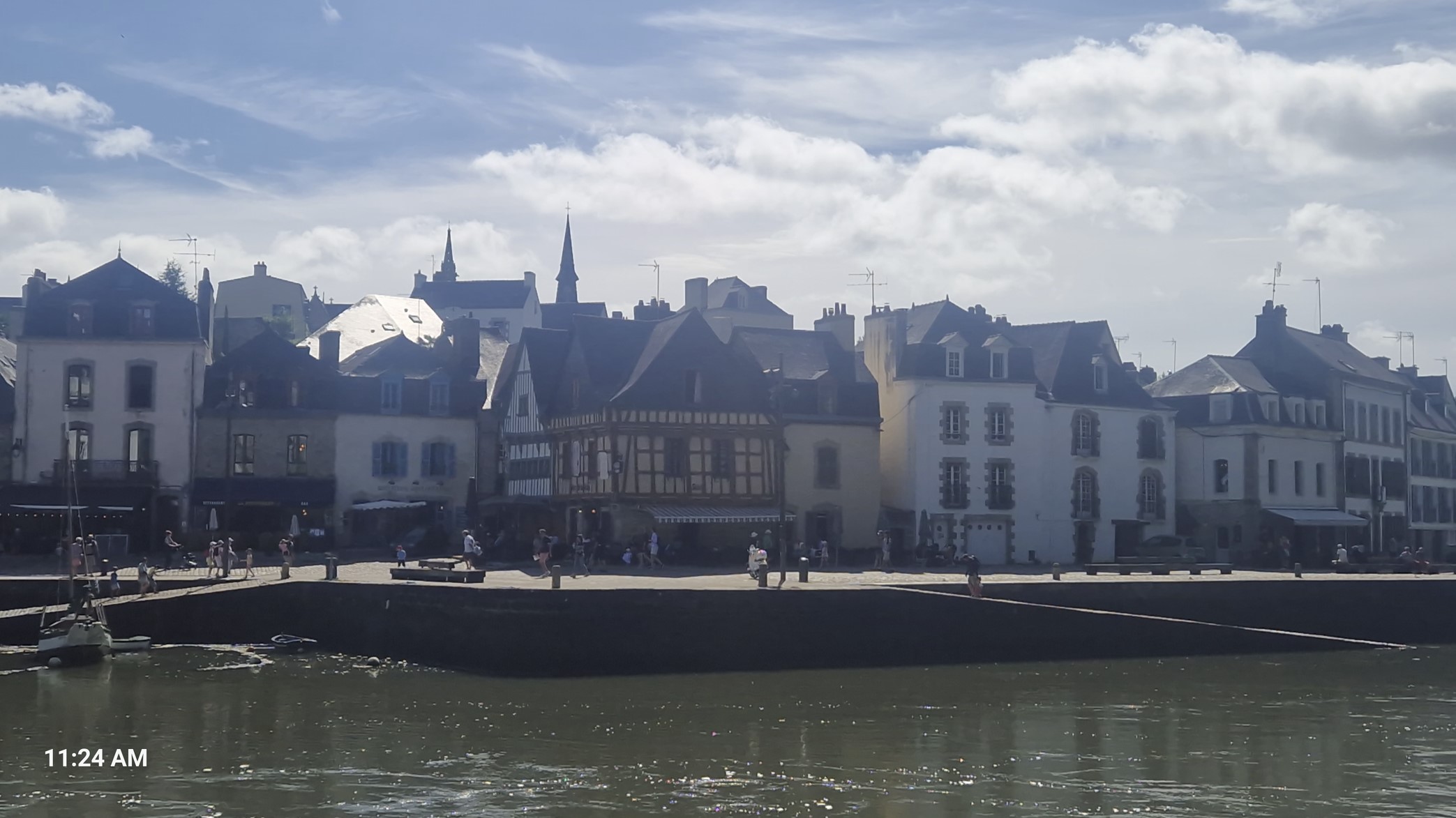
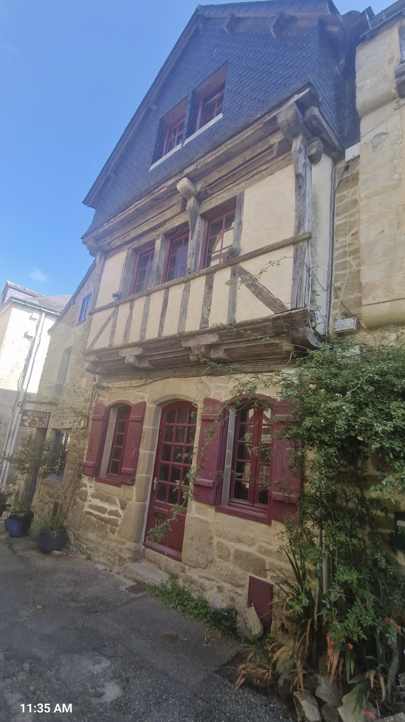
It was not all too far from yet another surprise at Aurey (apparently, it had one more name, which is Saint Goustan) When arriving to town, it looked pretty, but not all too special, but it was as I was judging a chateau by the guard´s house. When I got to the heart of town, I was amazed by it.
There is an upper and a lower town. The lower town is is clustered along the banks of the River Loch and has a four-arched bridge from the 13th century. During the Middle Ages, the port’s strategic position meant that it collected duties from boats passing through. During the 16th and 17th centuries, the wine and grain trade made this place the third most important port in Brittany. The memories of that time still echo through the granite slabs, recalling the arrival of the American Benjamin Franklin, who landed here in 1776 to meet King Louis XVI (I will admit that I completely missed this last attraction, shame on my head).
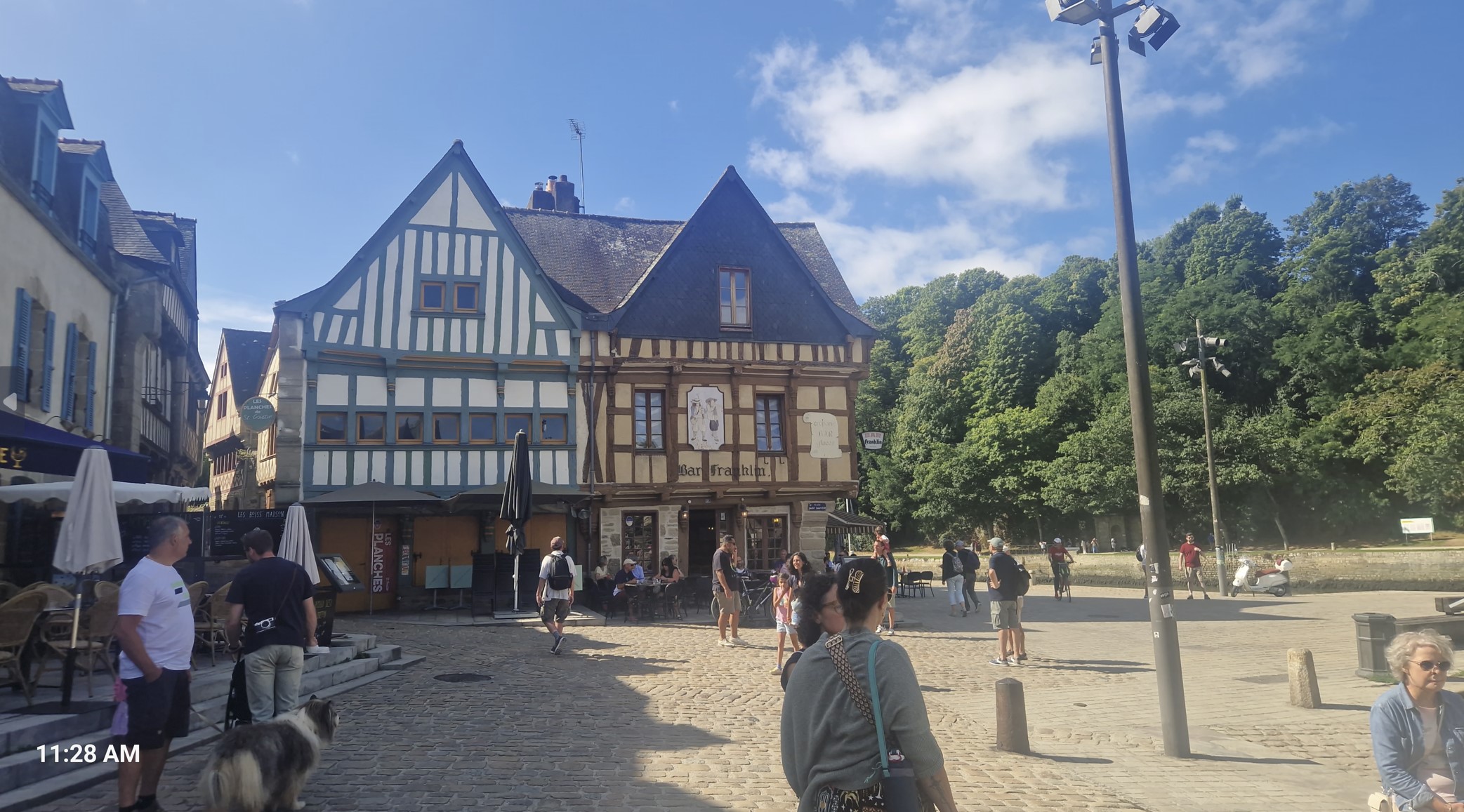
Narrow and steep streets lead lead up to the upper town.
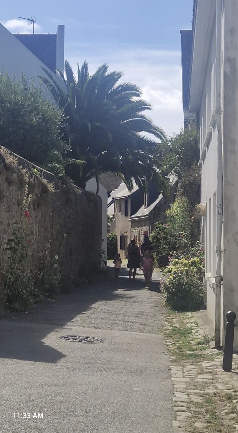
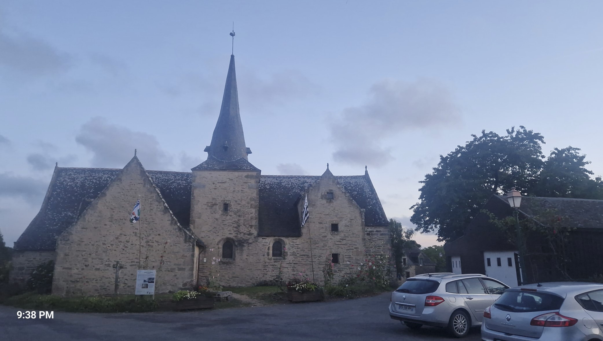
In the upper town one can find the Church of Saint-Gildas.
I had some food at a park next to the river, then spent a few minutes pondering as to how to proceed - once or twice on a month-long trip, I do end up doing that every now and then. Had I continued straight towards the west, I would have hit the city of Vannes, but would have gotten far-far away from the Gulf of Morbihan, which someone told me was a highlight. A better option was a ferry, which meant riding south to Locmariaquer and getting to the other side. So I went for that option.
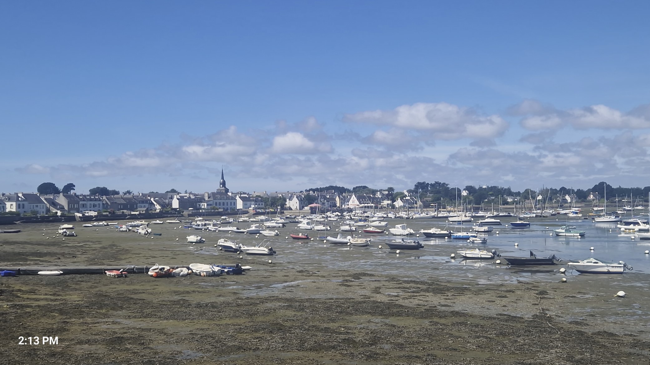
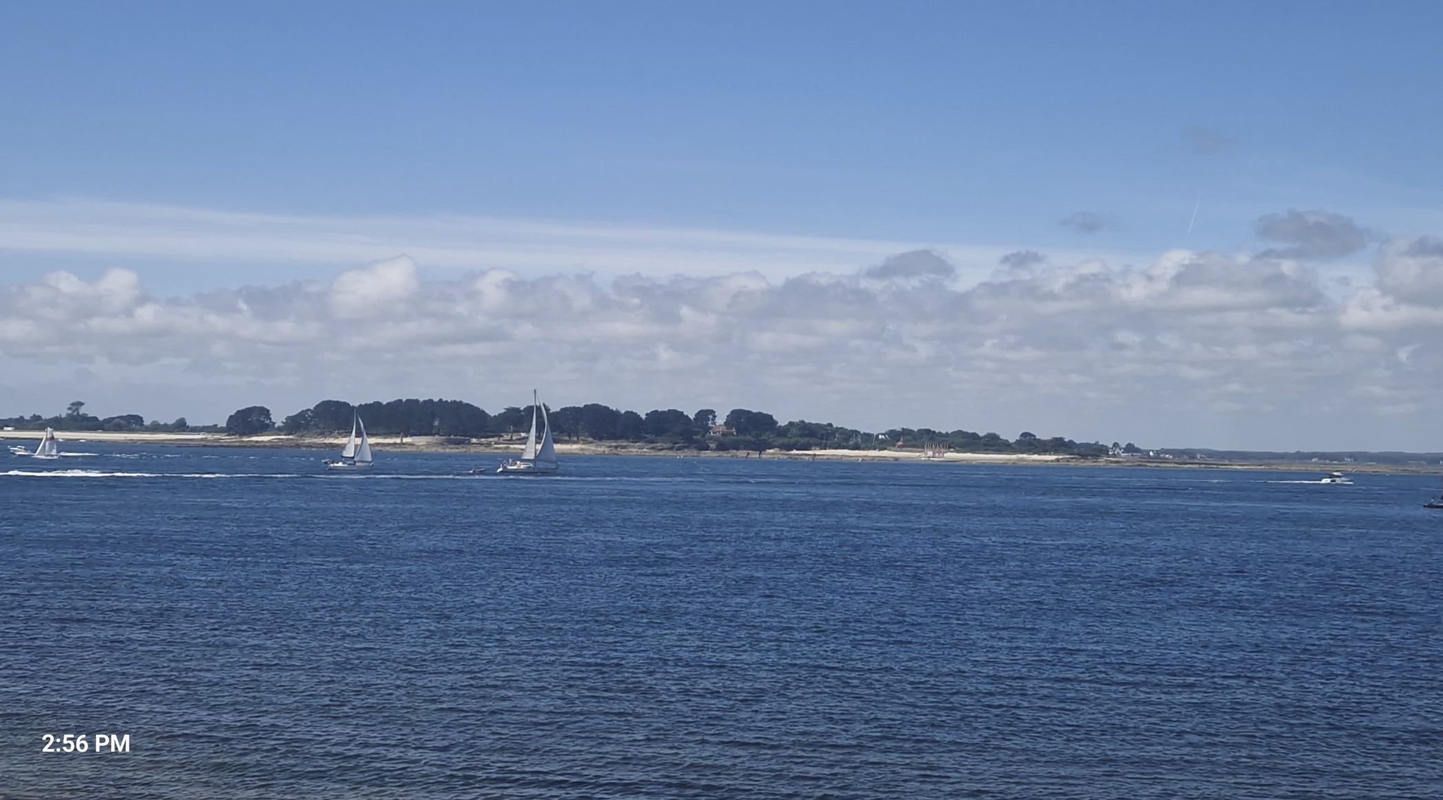
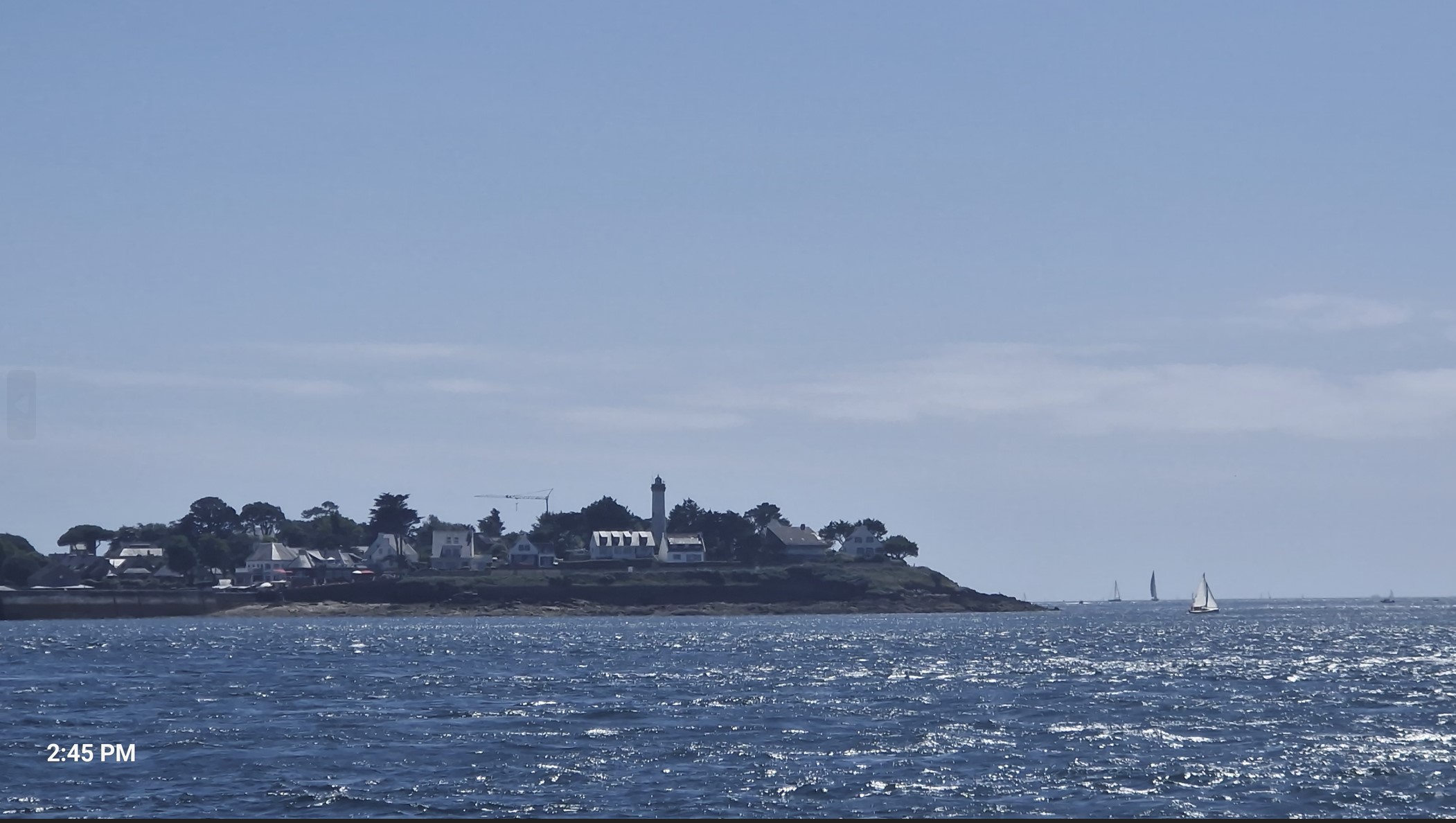
When I was nearing the Locmariaquer, I was wondering how on earth would a boat be able to make the crossing, the tide was so low, see below (that rhymed!). And I was wondering about everything else, as I had a hard time finding a reliable website showing the crossing times and place of embarquement of ferries.
It was just short of 2 pm and I had the feeling - a kind of a fifth or sixth or whichever sense - that there would be a crossing around then, so I started pedaling hard, without really knowing where I was riding to. My first guess was an incorrect one, I did find some water (more than on the picture above), but it was just small tourist boats doing tours of Morbihan Bay. I was being sent from pillar to post (as they say) and the clock was ticking. Someone told me that I should have had to make a reservation earlier and that it was now too late. I then found a sign for a ferry, saw a long queue for tickets, when it was my turn, it turned out it was not the correct line - but no-one could tell me where the right one would be. It was then that I spotted a family on their bikes and they finally they told me to follow them, and we went a block or two further, where a ferry was already approaching. Yes, that 2 pm feeling was quite correct, the exact departure time was at 2:15.
The issue was that I still did not have a reservation and my phone was literally dying, not having been fully charged for two days in a row. The father smiled, took out his phone, got my credit card and easily made a reservation. Looking back, I actually think he had purchased a children`s ticket for me, as it had cost just €9, instead of €16 - but this seemed to have fallen through the cracks.
There was quite a crowd making the crossing, a larger ferry was completely full with pedestrians, so an overflow ferry came to haul the cycles. I was glad when I finally boarded - the preceding half an hour had been quite an ordeal. On the positive side, I did not have to wait a single minute, but I also missed out on the megalithic site of Locmariaquer, a highlight. Next time.
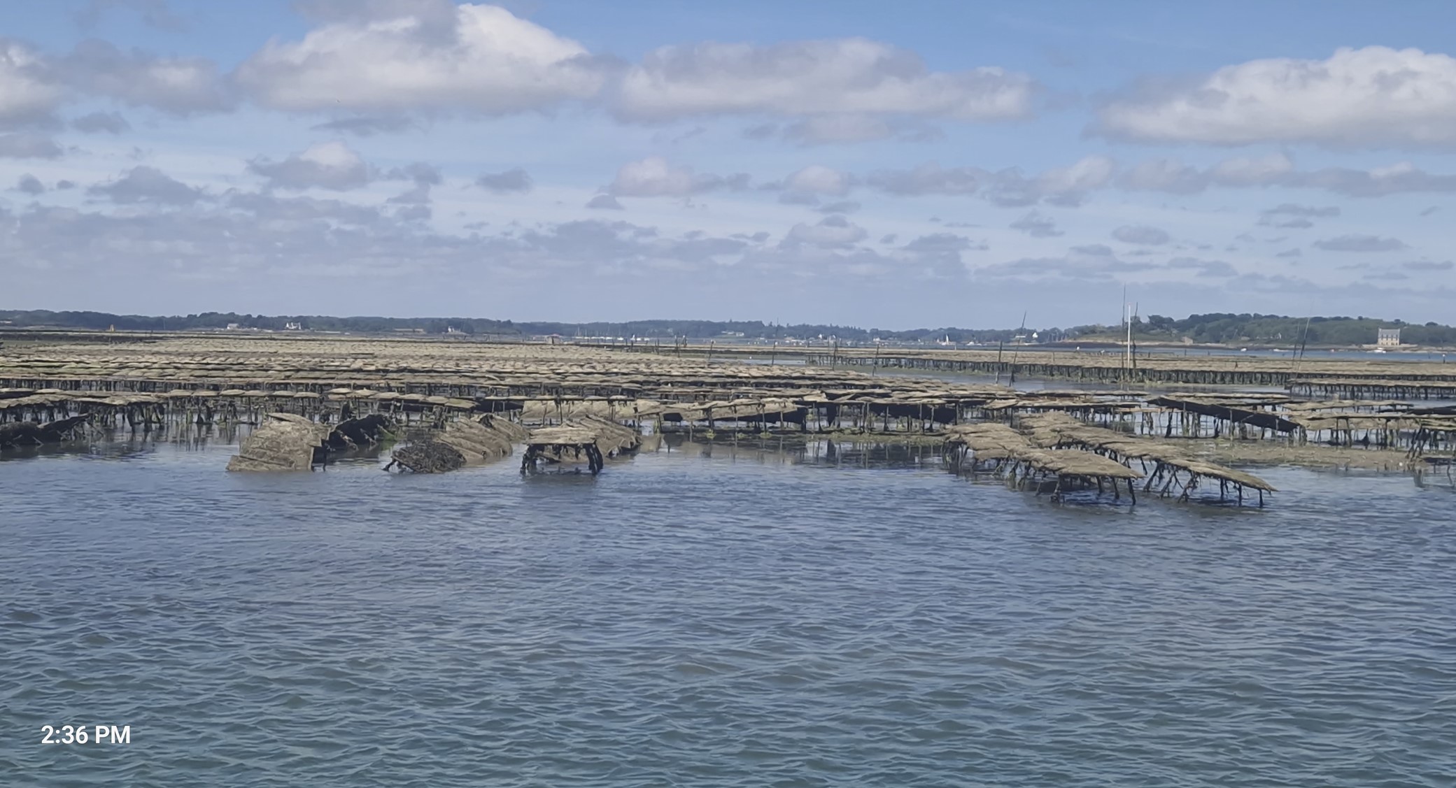
The crossing itself was pretty. Morbihan in the Britton language means "little sea" and these were the very waters I was now sailing on. It is hard to say whether ocean has invaded the countryside or is it the other way around. There are more islands and islets that one can count on the 40 square kilometers between Aurey and Vannes. You will find oyster farms, tiny little ports and anchorages with little sailing boats, a bird sanctuary - a beautiful mix of blue and green. There is even a 100 kilometer walking path, called the GR34, where, if timed well around the tides, can be absolved without getting wet.
The town on the other side was called Arzon, supposedly the village with the largest coastal area in France. As I am writing this blog, I noticed that I missed visiting a major chateau, Suscinio Castle. Yet another reason to return.
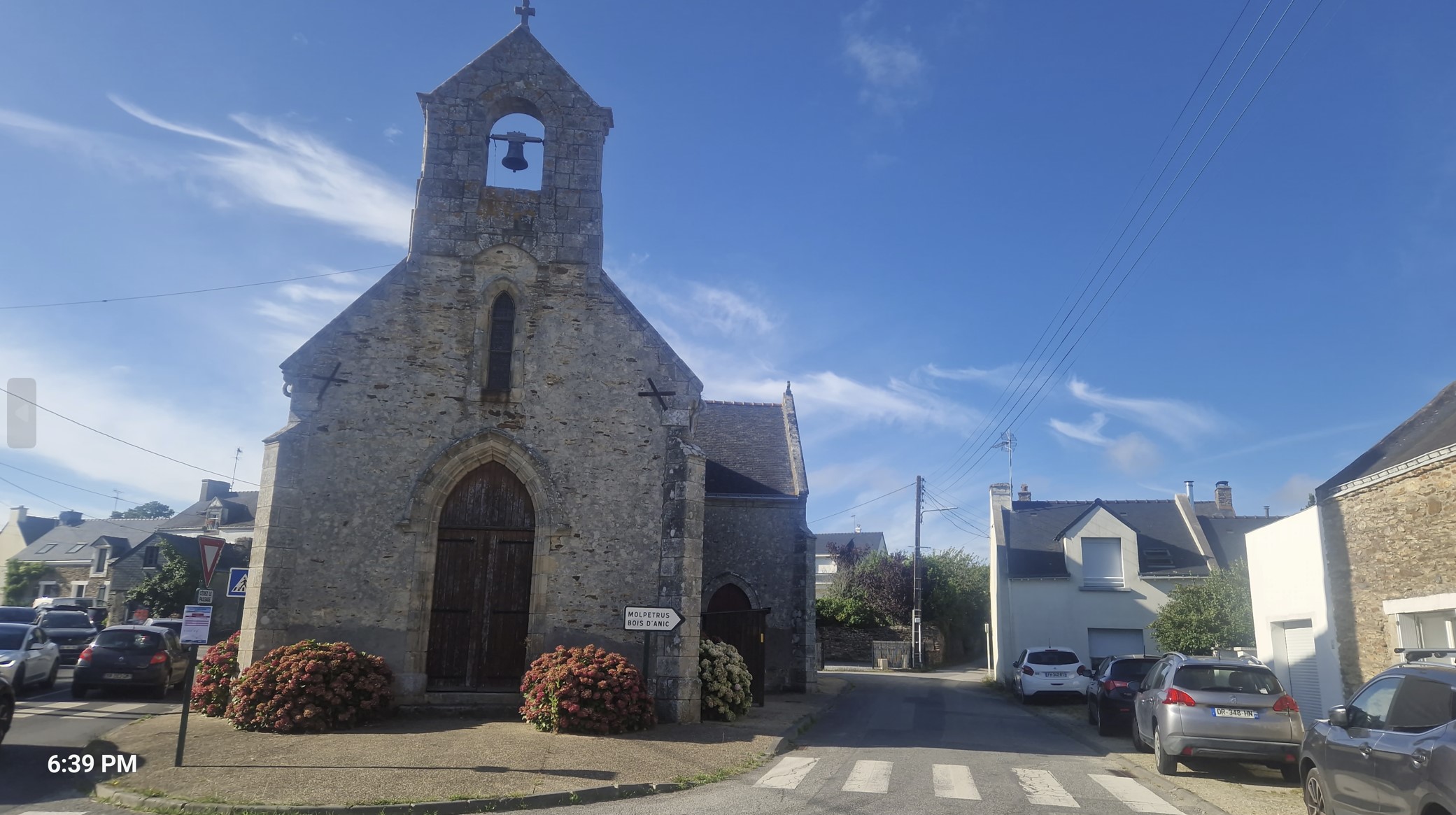
In the afternoon, there were no special highlights (as far as I can remember), I rode by small towns, with pretty churches.
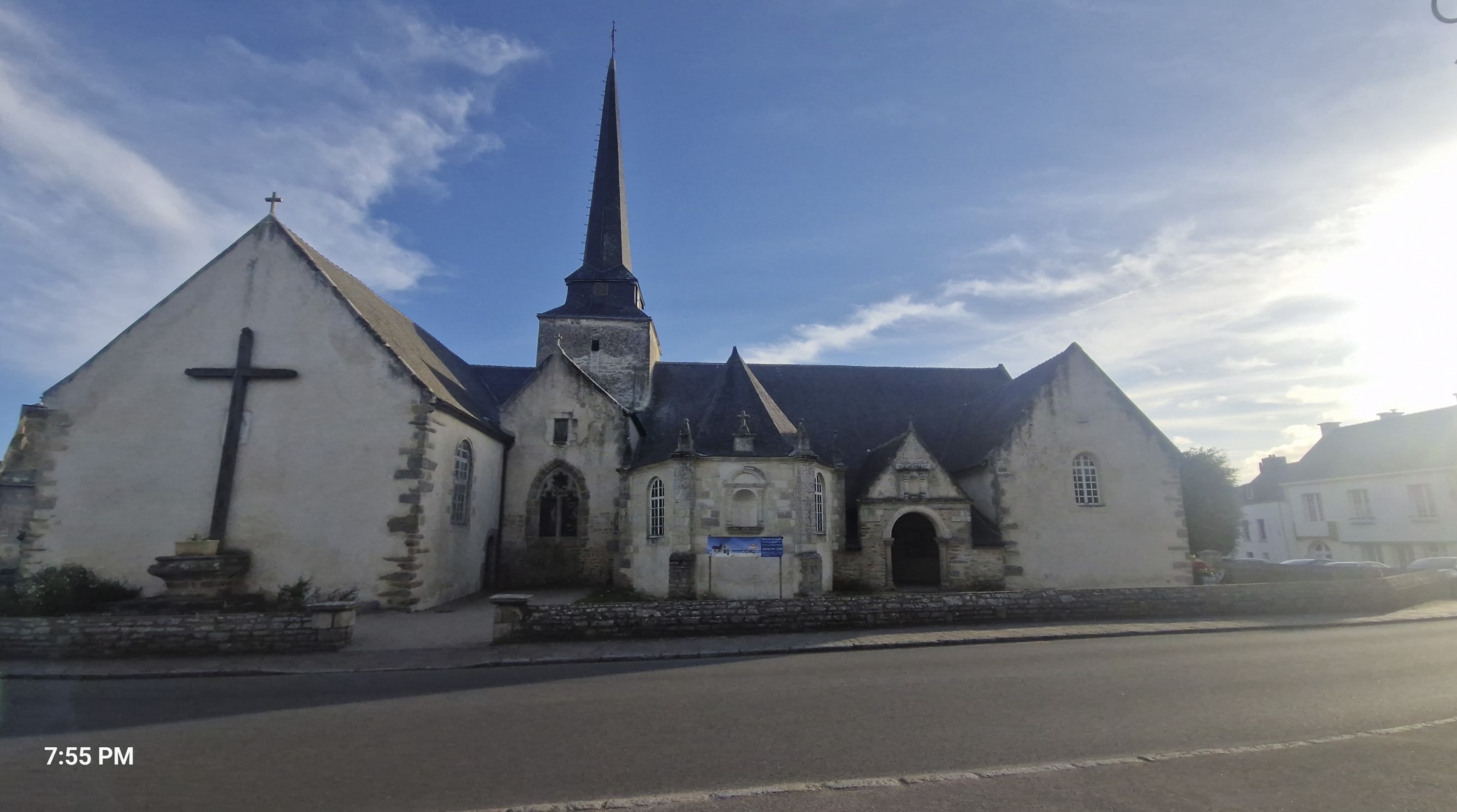
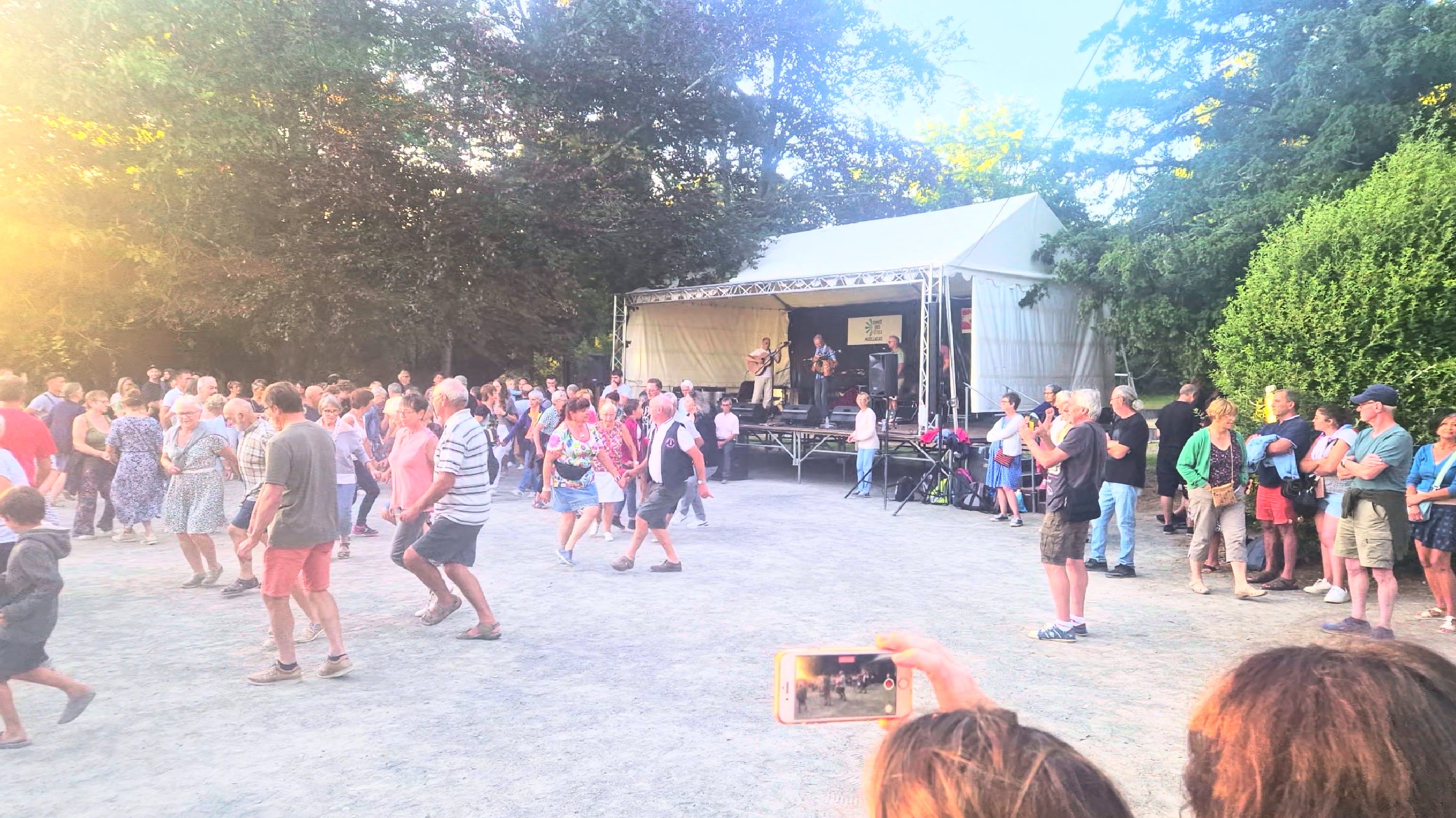
There was indeed something noteworthy when I got to Muzillac (population: 5,000). I wanted to salute the nice church by taking a snapshot and then riding on, when I heard loud Celtic music. There I saw a park with young and old dancing happily to the merry tunes of this music.
A bit of an incline followed, then I reached Arzal. There I played with the idea of sleeping at a hotel, but I realized the weather was nice, campground were plenty, so why not save some cash. I saw a bridge further up the road, but also a dry riverbed, on the other side of which was a camping. It was not the best idea, what the crossing was concerned. The riverbed was dry all right, but it was also incredibly sandy, so I quickly had to get off the saddle and push and shove my heavy bike through the sand. It was quite taxing and, even worse, all the bike parts, especially the brakes, were full of sand - till late next morning, they gave quite a weird noise when applying them.
The campground called Les Embruns was full, however, two young friendly receptionist girls did manage to squeeze me in, somewhere close to pool (which was by now closed) and the shower room and charged €10 for that. It was yet another 5-star campground, but as far as I could see. All my gadgets were close to empty and I started "feeding" them, keeping them charged for the night.
It was yet another roughly 100 kilometers that was behind me.