Biking Day 24
- Length ridden: 108 km
- Ascent: 460 meters
- Rating: 7.0 out of 10 - nice day, but Mont Saint Michelle did not capture me
- Highlights: Granville, the friendly guys at Cara-Meuh!
- Lowlight: A bit more of sunlight would have been preferable
- Map of the day
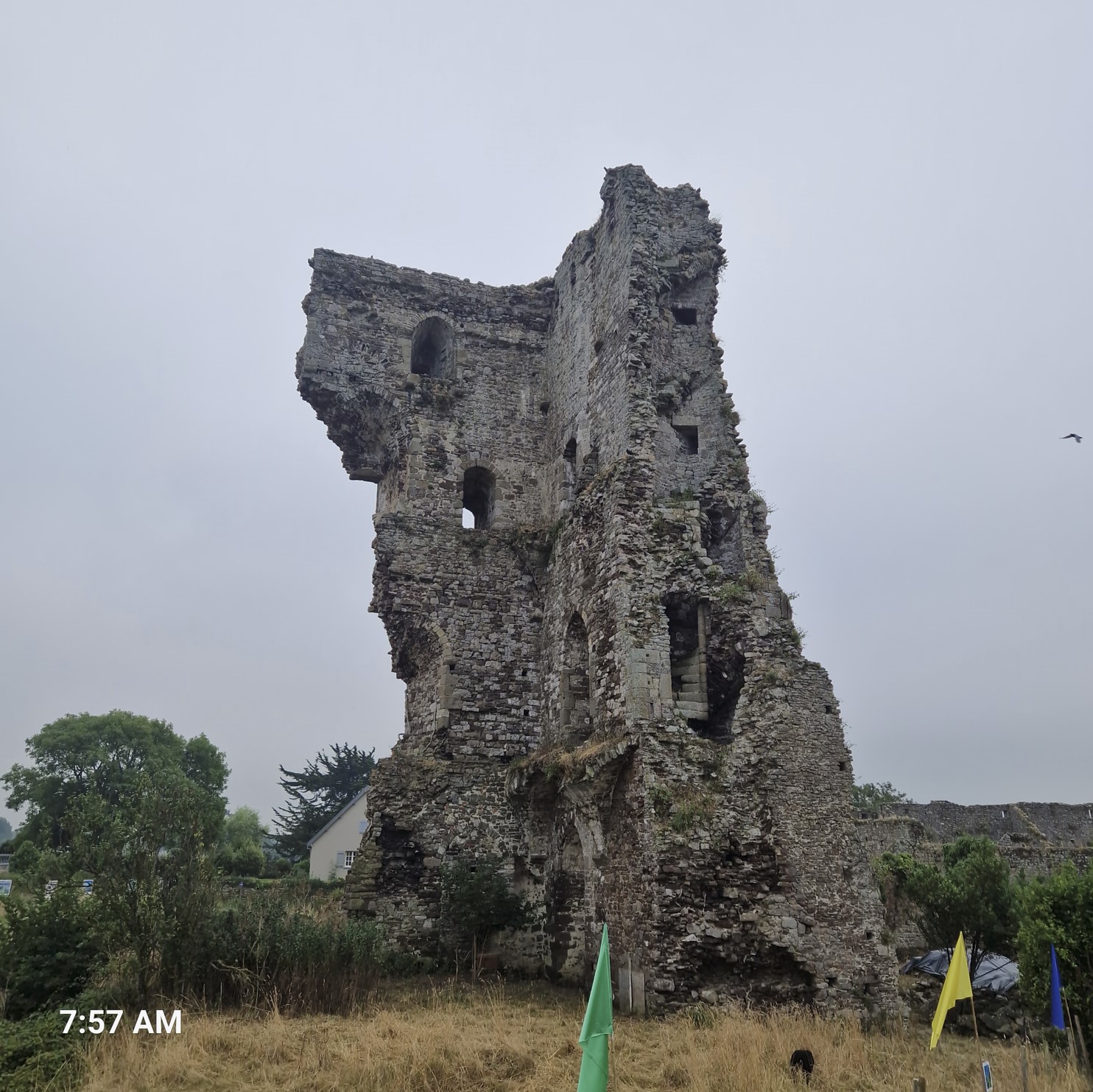
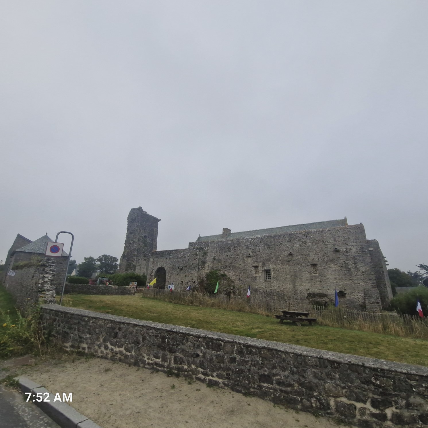
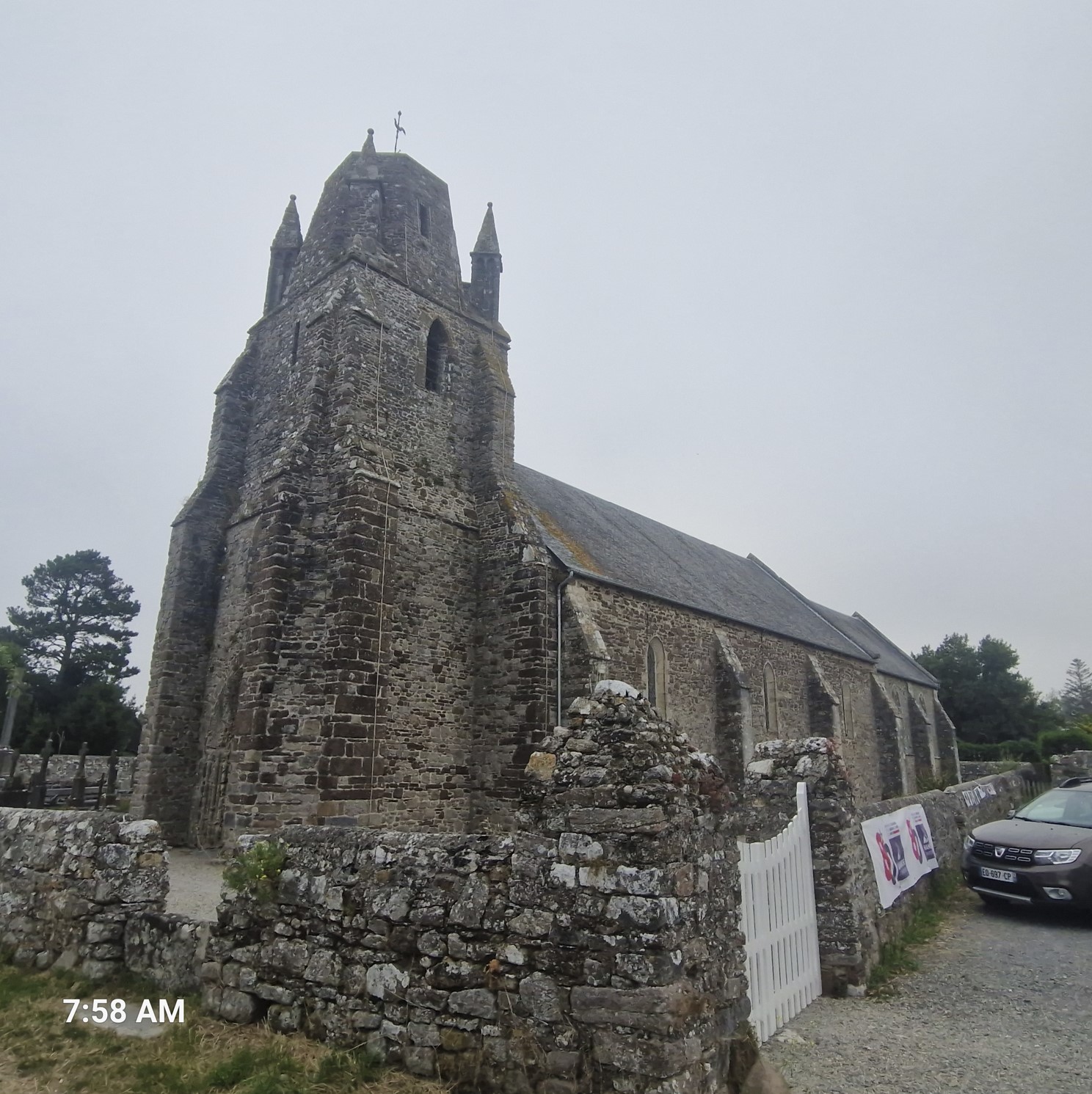
In the morning, I did not wait for the host to show up, the price of a stay was €13, so I handed €15 to a guest with my name and asked her to check me in later. Leaving around 8 am, I noticed that this small village called Regnéville had ancient castle ruin from the 12th century right in the middle of it, next to an ancient church.
There were also large lime kilns from the 19th century, but as the site only opened at 10 am, I did not stop there.
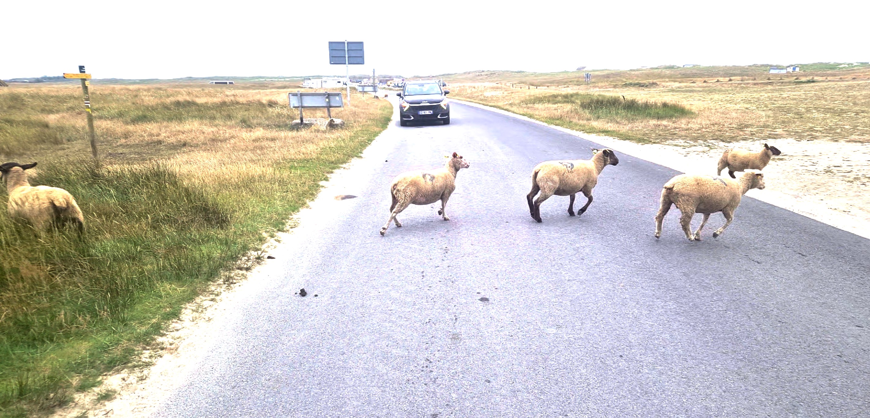
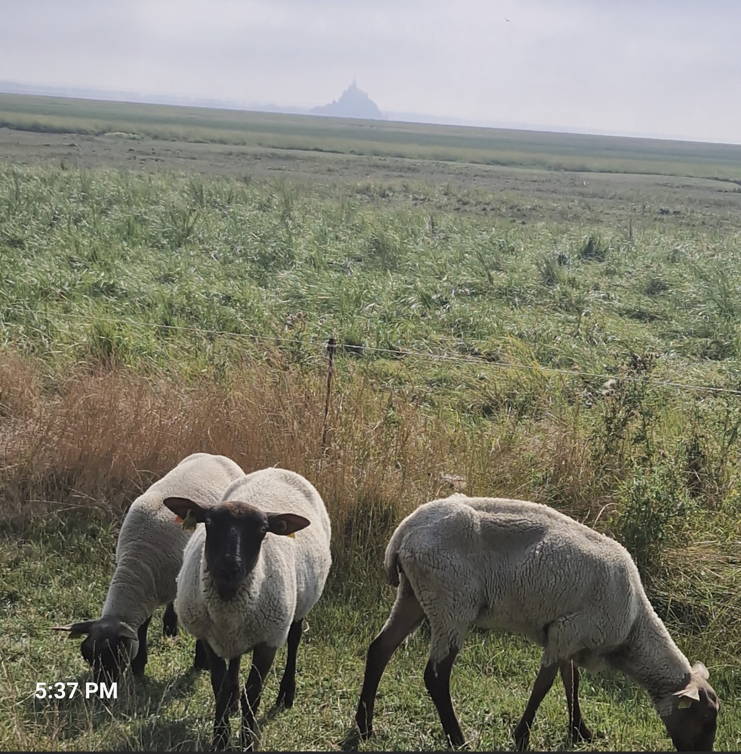
Similar to the previous day, I was on very small roads, where sheep were wondering around freely.
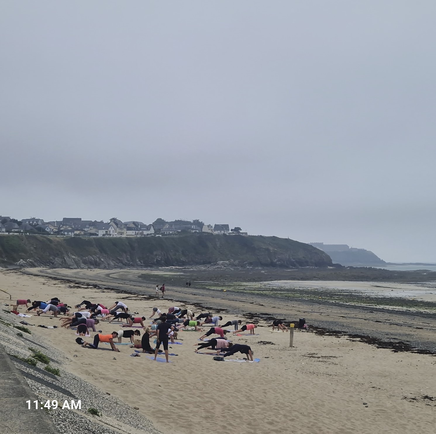
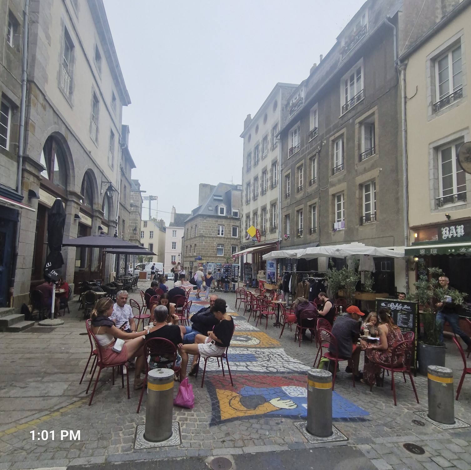
I reached Granville by around noon, without knowing what to expect. At the beach, I saw people doing yoga.
At where what I incorrectly thought was the main street, I had a quick pastry/pizza lunch, there were a couple of pretty scenic buildings - but had no idea what Granville was about. Here I met the British father and his two sons, I told them that I overheard them fighting the previous morning, they laughed it off. I asked how they were able to make some 100 kilometers or so in a day on foot; the very reason they were fighting is that they had to hurry to reach a train. They were on a 3-week-long hike, just the three of them...coooool.
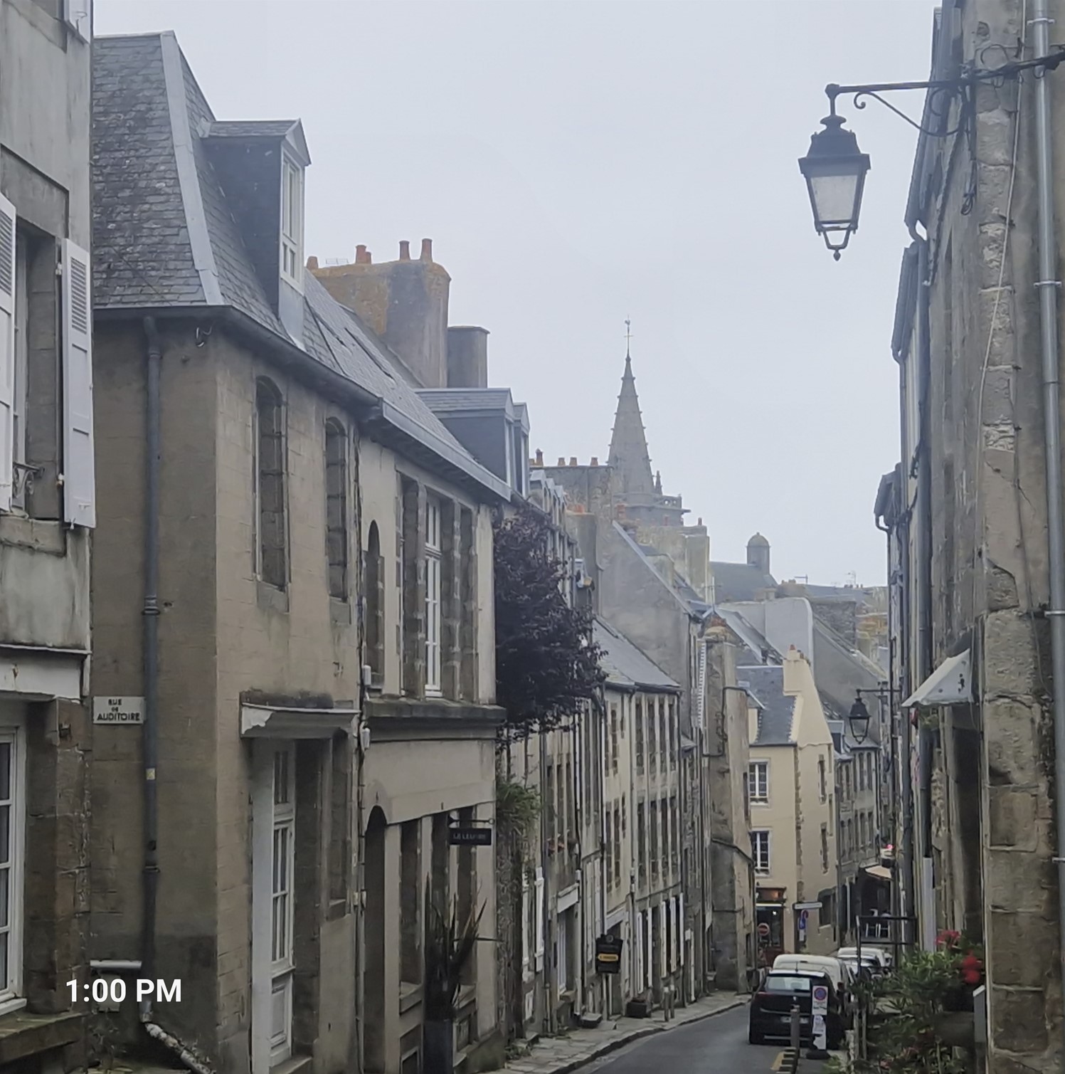
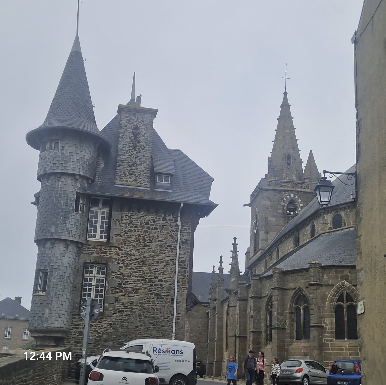
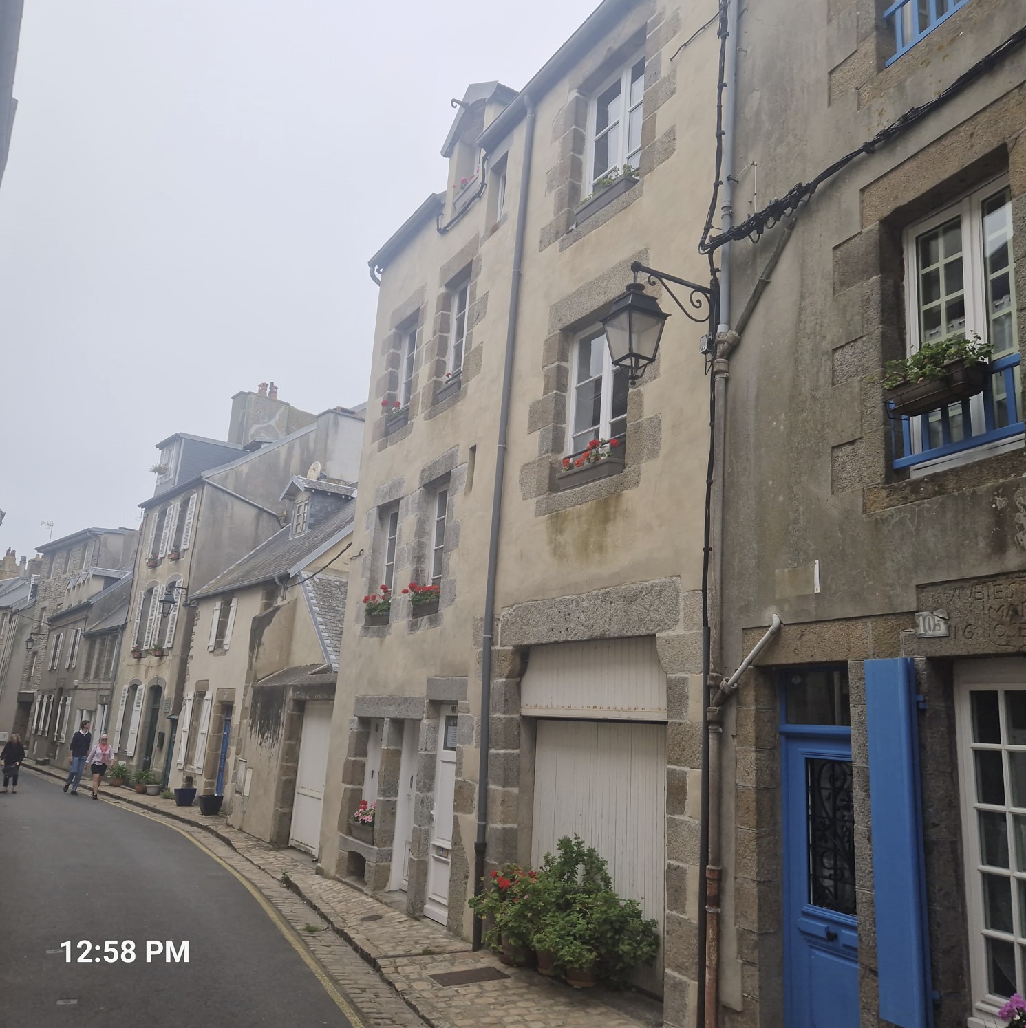
I rode on, thinking to have seen the town, when it turned out it was a grand town indeed - and a very nice one for that matter. Up on a hill was the Upper Town, with a gothic cathedral and stoned mansions. In good weather, Mont Saint Michel can be seen from this town, but it was quite overcast that day.
In the Upper Town, I was cycling the narrow streets and there was an alley where I almost hit a gentleman of Asian origin. He smiled and told me a better path to ride on. Originally thinking he was a fellow tourist, I asked him where he was born, he replied he was from Paris and had his second residence in that narrow alley in Granville. I asked how he found the place, his answer made me gulp. He told me he was on his private airplane flying to Jersey and Guernsey, when he landed in Grandville and purchased the place. Oh-oh, some people have all the luck - but then I cannot complain either, being on a multiple-week bike ride.
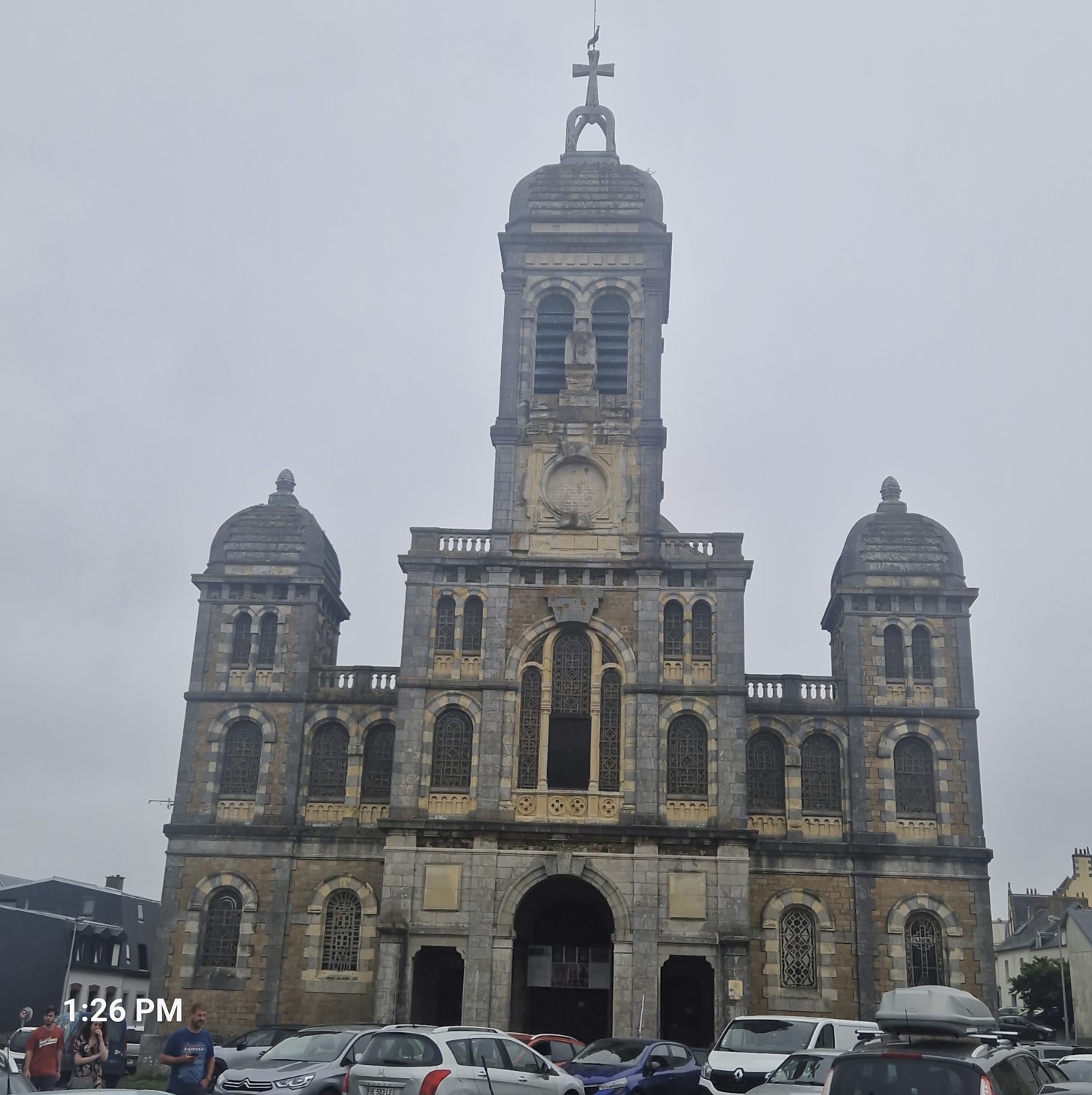
In the Lower Town, there was a casino and the Christian Dior museum, Dior was born there. The extravagant clothes he designed in his youth inspired the annual carnival.
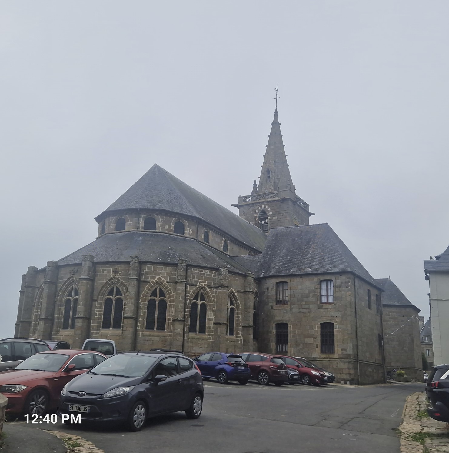
Opposite Upper Town was another hill with a major church on it, however, this was closed. There was a wonderful view from there to Upper Town.
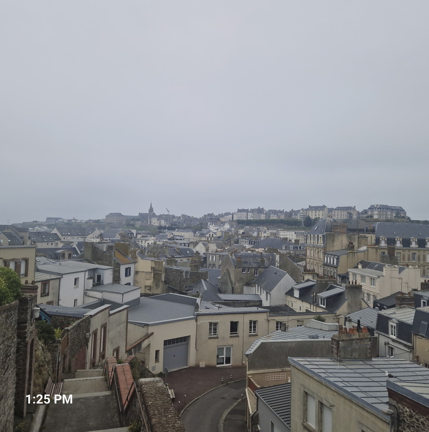
I have to say Granville really impressed me and it is a place where I would happily return to.
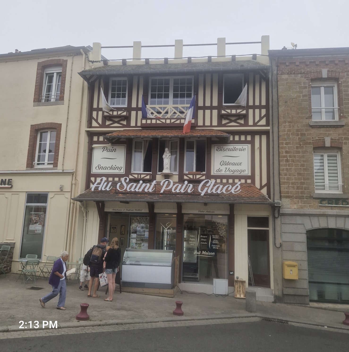
At a bit after 2 pm, I got to Saint-Pair-sur-Mer, I liked the look of the ice-cream parlor (but did not actually try it).
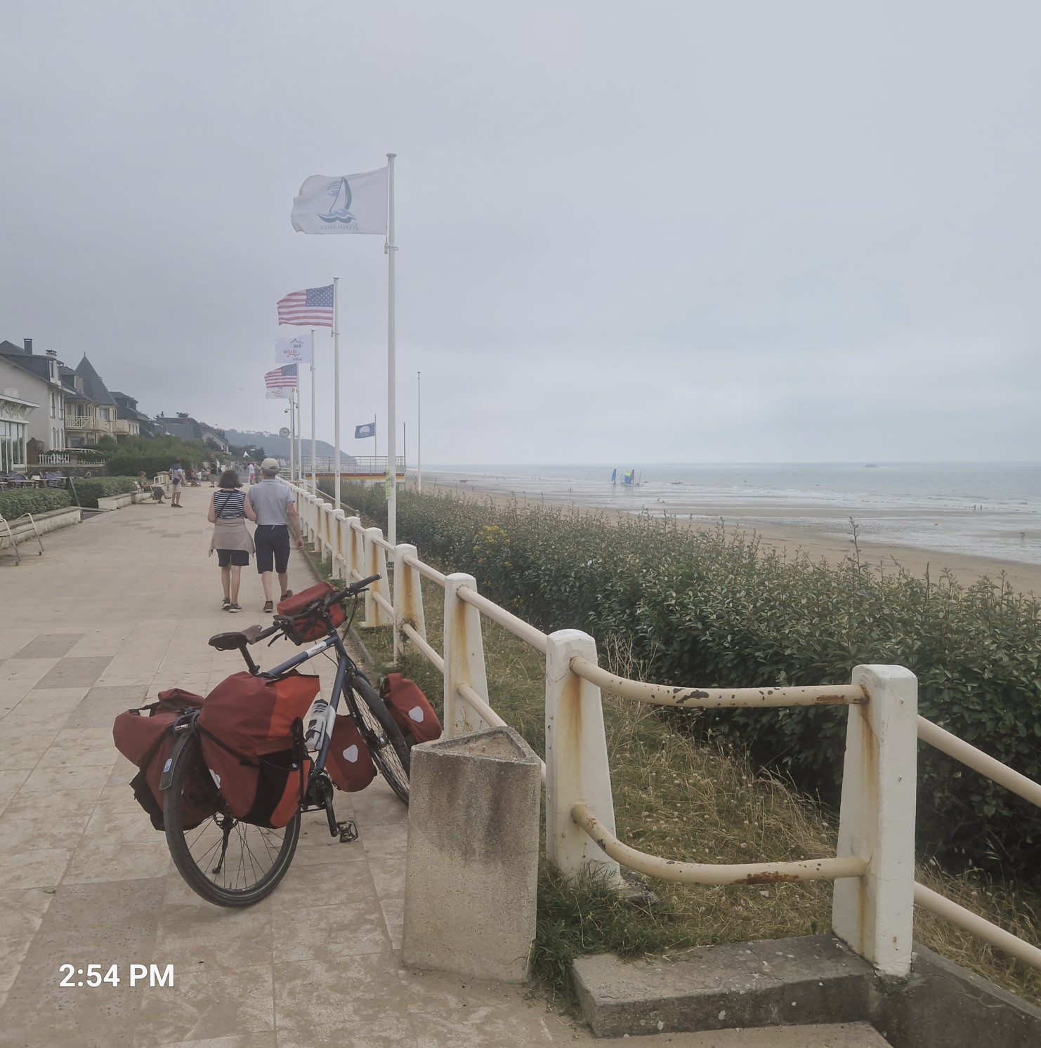
Julloville-les-Pins had a long beach, but I did not feel tempted to make a dip into the Channel. There were paragliders enjoying the winds - and the town was preparing for some artistic festival. After this town came quite a climb, lasting a few hundred meters.
In the afternoon, I got definitive proof that zebra is a French animal.
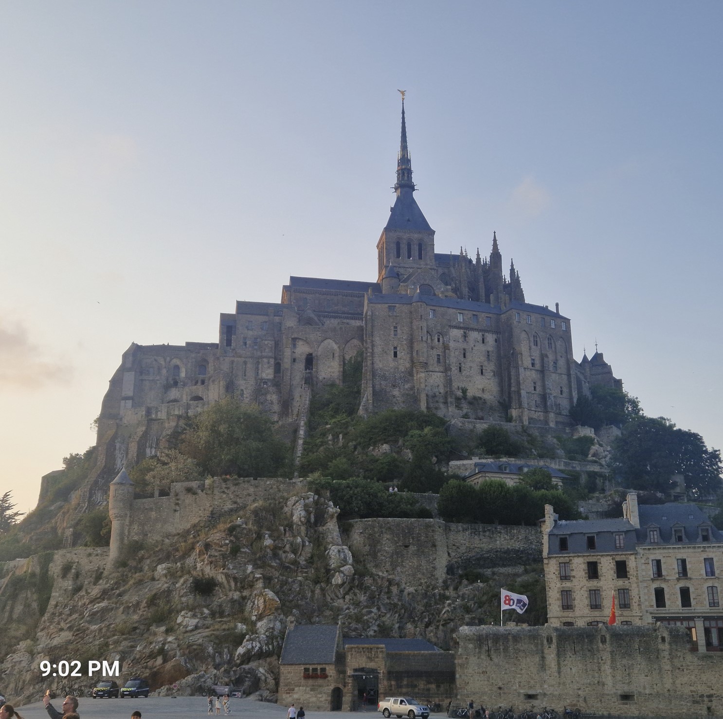
Now I was nearing one of the main attractions not only of the area, but entire France - supposedly the second most visited site, right after the Eiffel Tower - and this was Mont Saint Michel, which I will refer to as MSM. My parents have been there a few years ago and were amazed by it, staying at a hotel vis-a-vis the town (BTW, the small hotel cost them a fortune...).
Still far from MSM, someone pointed out the contours of the hill MSM is located on - but I could not capture it on the camera, as it was a bit hazy. Later at, around 4:30 in the afternoon, I got the first pretty good photo opportunity and I grabbed it at its arm.
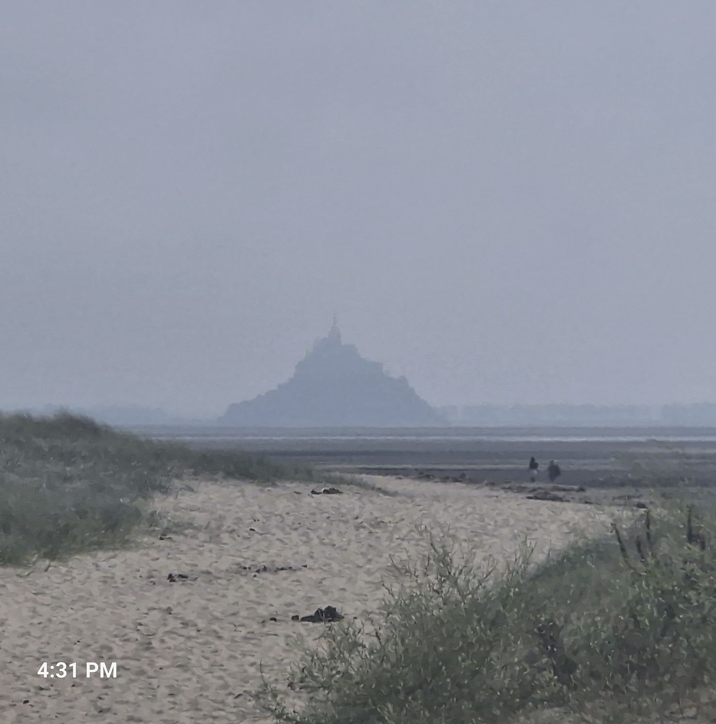
The highest tides in continental Europe are found at MSM, reaching a difference of up to 15 meters (!) between low and high tide. During high tides, the sea withdraws 15 kilometers (!) from the coast and rises very quickly. From the place I took this photo, on the coast next to Genêts, MSM was about 5 or 6 kilometers away.
Vains was the name of the next destination, where I found a small stone church and a large family-owned cheese manufacturing called the Cara-Meuh Farm. There was some kind of an event going on, a lot of beer (not milk) was flowing and quite a few people were there. I drank a refreshing glass of beer and filled up my cheese supply. The friendly guys at the beer stand spoke good English and asked me if I was going to MSM, I said yes. If I hurried, they went on, I could make it over the inlet on the bike and not get wet, but I would have to leave immediately. The other alternative was to ride on the road around it, which was roughly a 35 kilometer (!) "detour", or call it whatever you want.
I pictured myself, not a feather-weight guy, riding my fully-loaden steel bike with 5 bags getting in the muddy terrain of MSM and the tide coming in, everything getting more and more wet - no thanks, I´ll leave this experience for another time, another adventure, So I set off on the "official" road, veering around an inlet.
It was actually quite a pretty patch of road, a part of the way it was a biking and hiking road with fences, to keep the sheep and the cows from loitering around.
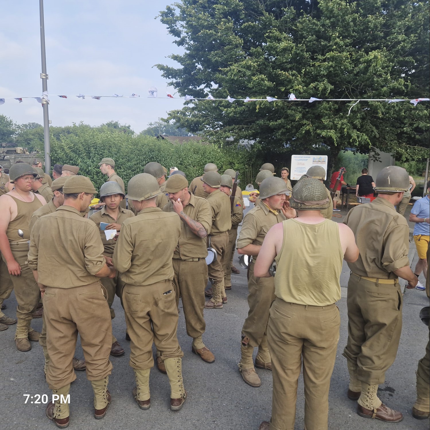
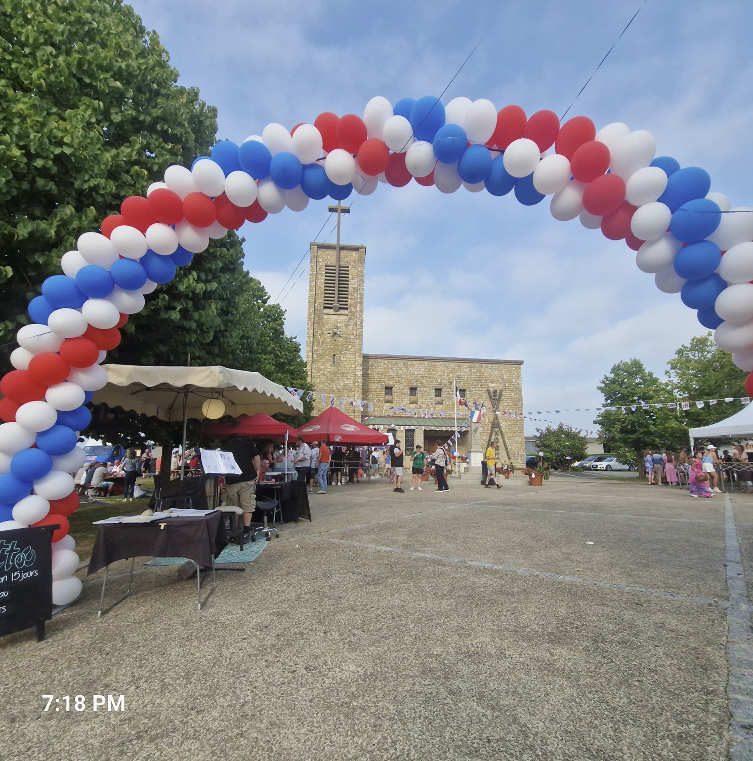
A bit later, (finally) reaching a paved road, I got to Pontabault. If you read the brief Wikipedia link I just inserted, it says under the History section "Patton's VIII Corps crossed the Pontaubault bridge on August 1, 1944 into Brittany following the success of Operation Cobra". And what was the date that day? August 1, 2024, i.e. exactly 80 years later. To commemorate this, the small place was in a festive mood, with men dressed in as the Patton`s troops and everyone celebrating. I got some more gilettes - still no love affair with French food still, I am afraid.
It was getting late and similar to Patton having had a "master plan", I started putting one together for MSM. You see, that place is a town, which never closes, however, the chances of finding any accommodation would be slim - and even if I had found something, it certainly would not fit my budget. Also, I did not want to spend all too much time at MSM, as I figured visiting the town once would be enough. So, my master plan called for making it to the town, seeing the highlights late in the evening, when there is a low tide of tourists and then figuring out where I shall sleep at a later point in time. Fine.
Now I was riding on the paved road, traffic relatively light, when I saw a bike road toward MSM, however, it being cordoned off - here I decided to go by the barriers and start riding toward the (semi-)island. Well, the most probable reason they had this barrier was that the road must have been washed out by the rains, it was an incredibly bumpy ride - however, with beautiful views of MSM. There was a clever biker colleague of mine - he pitched his tent on this closed-down bike path right vis-a-vis MSM , having a beautiful view whenever he decided to look up - and nobody would bother him, except one other crazy rider, who does not take barriers all too seriously.
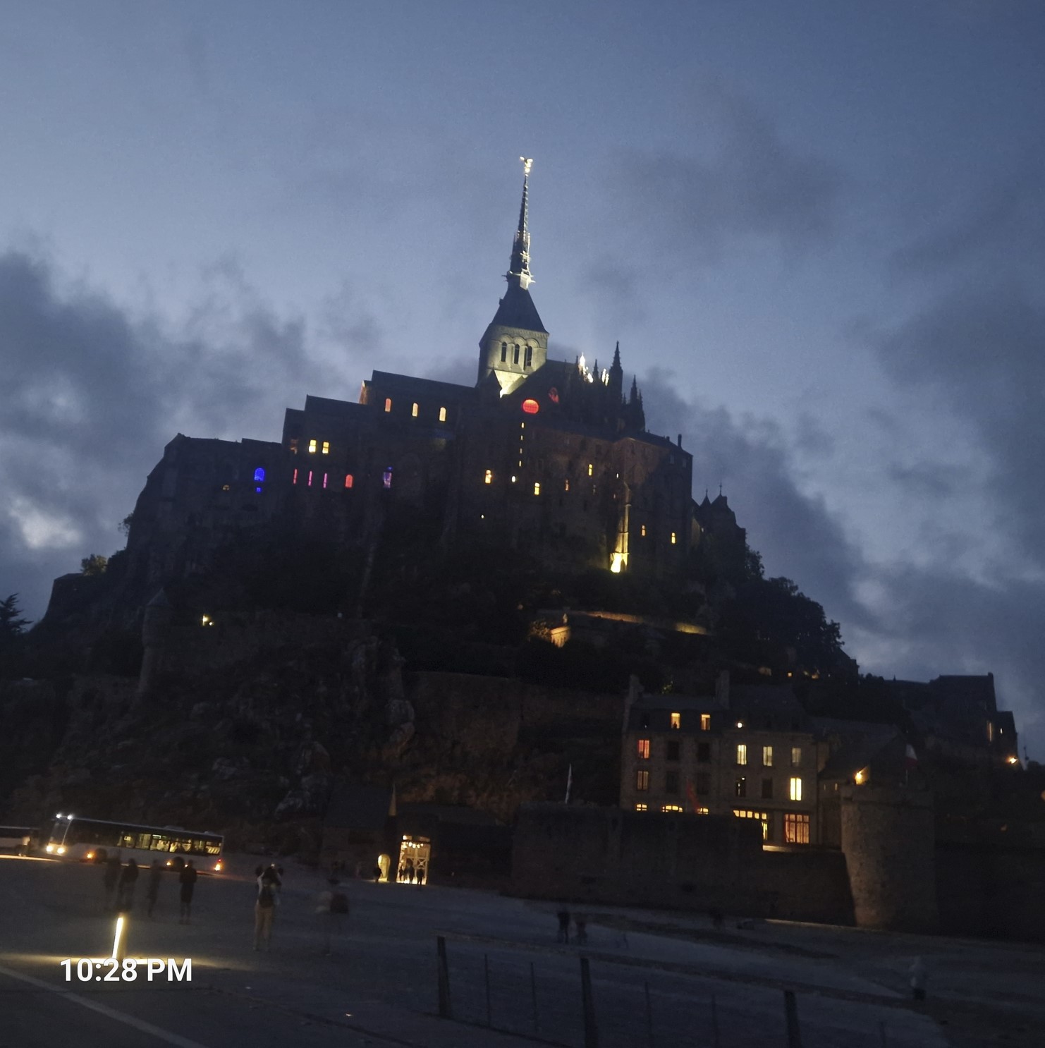
My master plan worked quite well, it was around 9 pm when I got close to town. I rode on the 2-kilometer-long bridge (only pedestrians, bikes and a local bus is allowed, cars need to park at the other end), locked my bike (well, the luggage cannot be locked, but I was hoping nothing would be stolen) and followed the stream (and not crowd, as it was rather late) of people walking up the stairs.
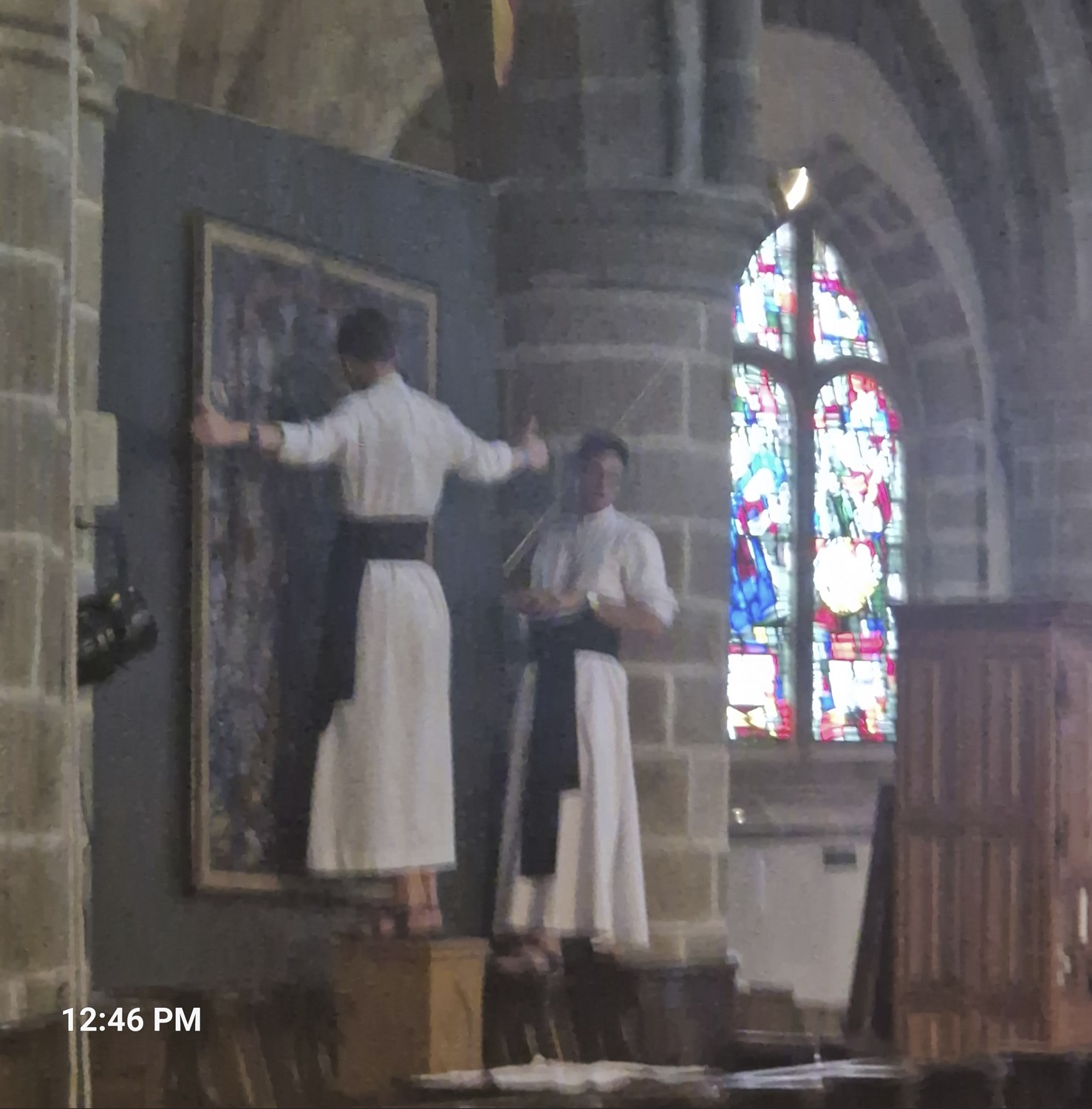
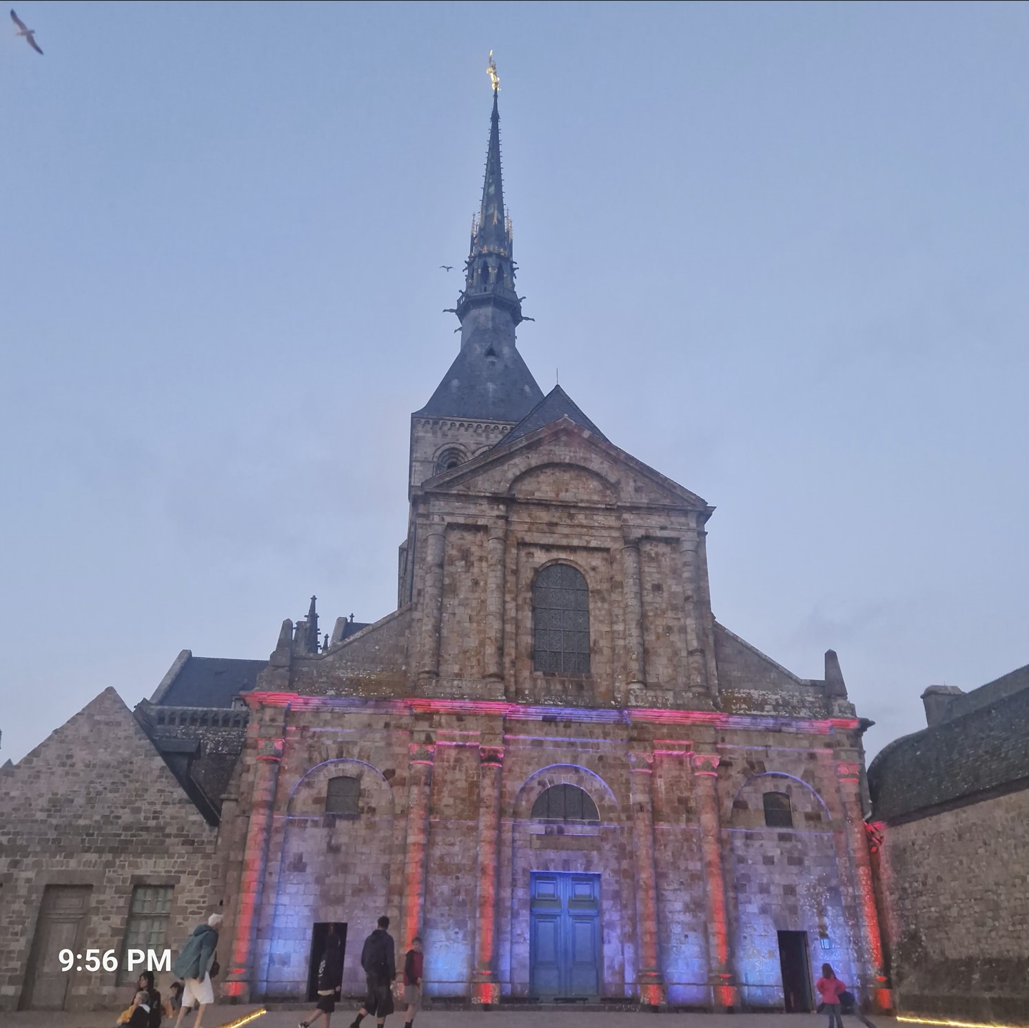
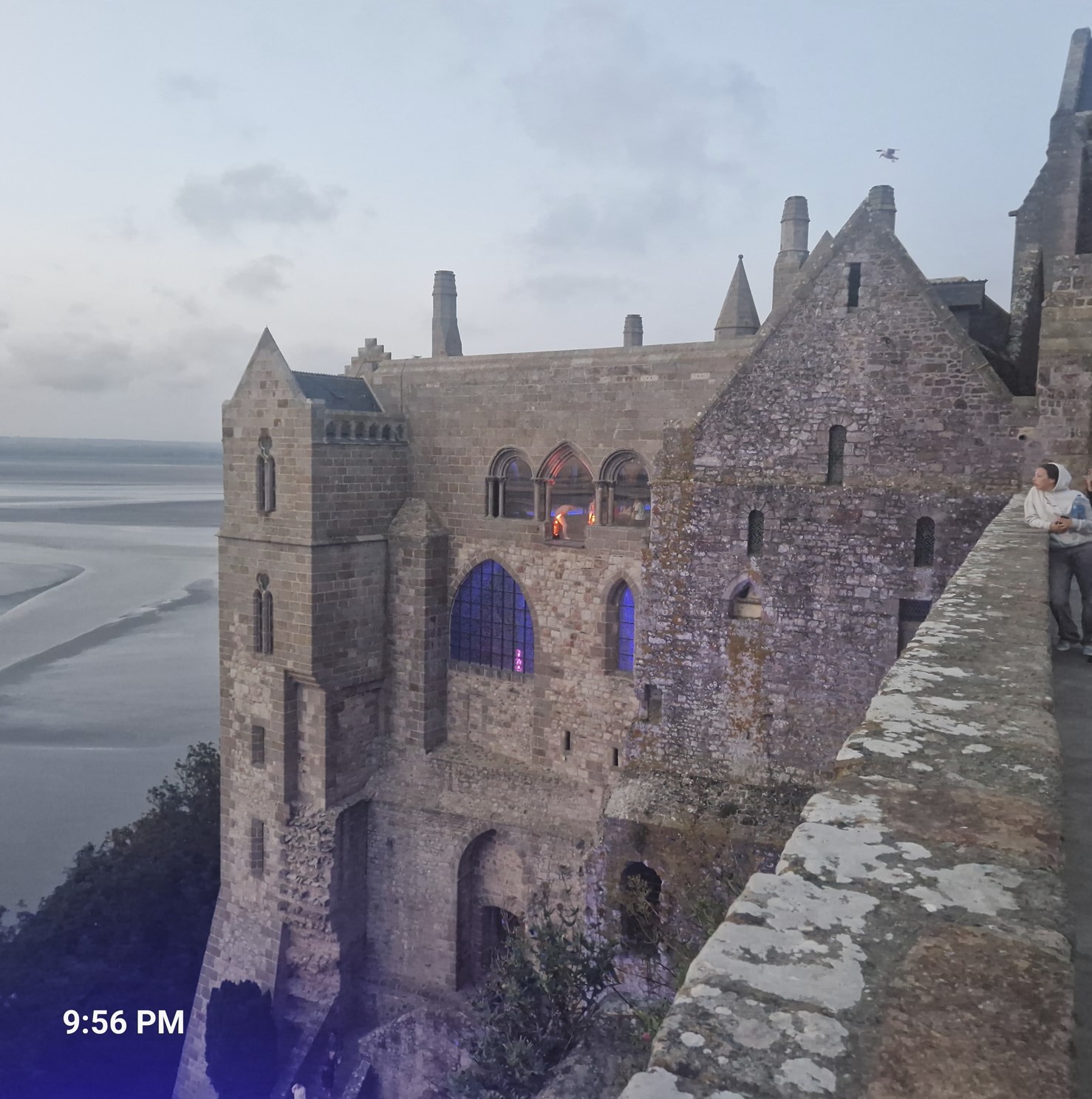
The main sight at MSM is its abbey. It would exceed the boundaries of a biking blog if I started writing about the past, present and future of this religious place, but you have a link and a billion other websites. The abbey had a 1,000 year old history (actually, 1,001, at the 1,000th was in 2023).
The wait time to the get into the abbey was about 20 minutes, which I did not mind, I spent it resting on a step. Once inside, they had a pretty amazing light-and-sound show in every hall - and there were quite a few of these - in various floors, connected by steep steps.
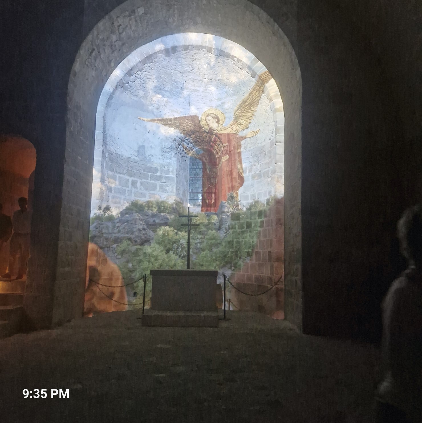
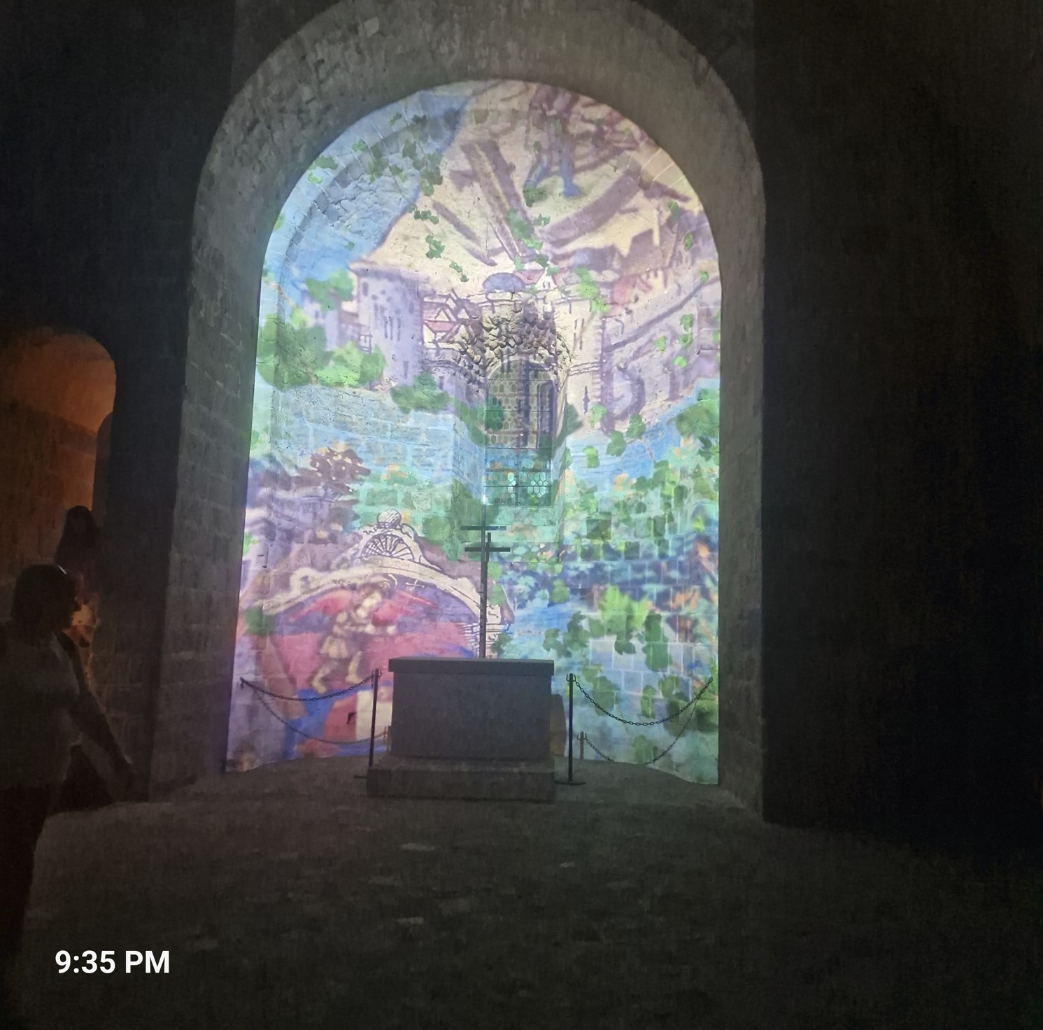
A few other pictures follow.
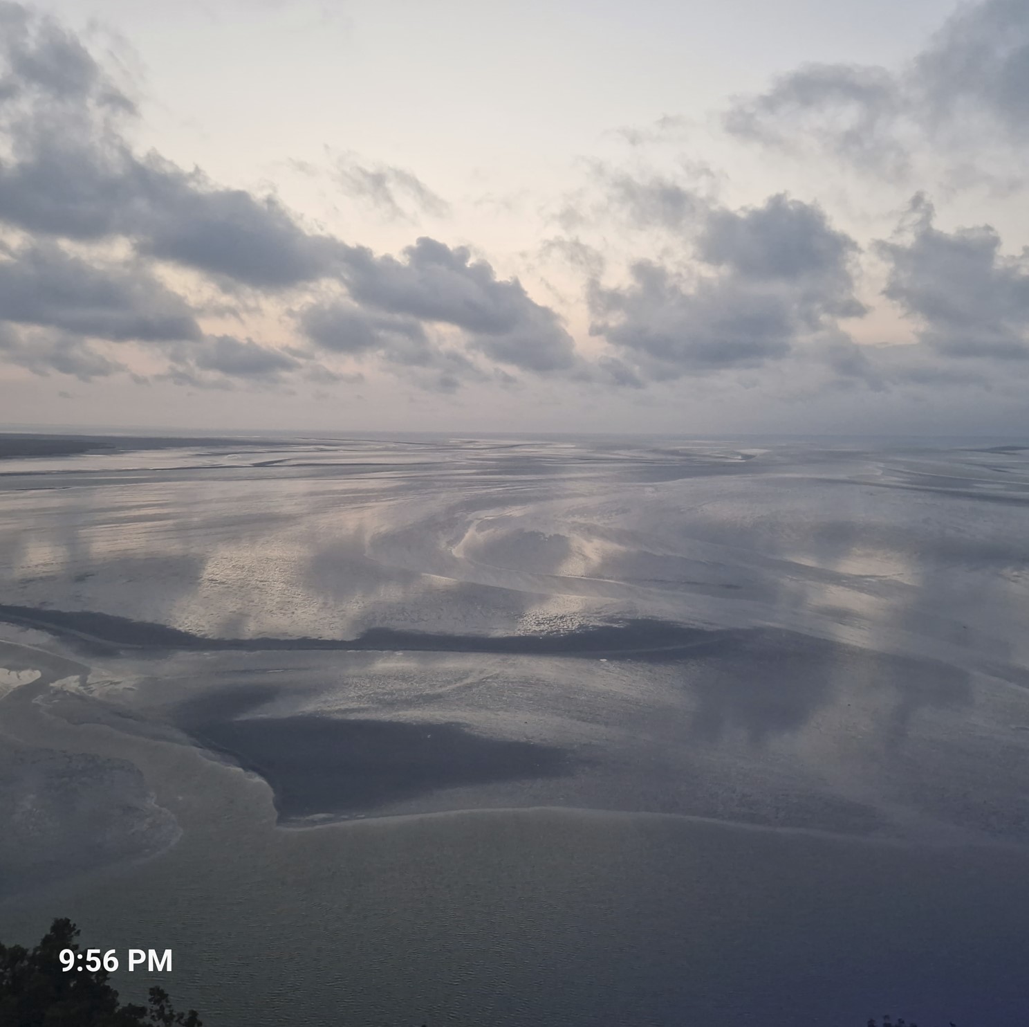
On the last picture, you can see the flood water coming in.
At around 10:45, the major part of my plan was complete, I was done with MSM, I got back to my bike - it was not harassed. Now to the question of sleep - I made a feeble attempt of finding a campsite, as I - correctly - thought they would be full to the brink. The caretaker, who opened up the gate (remember, knock and...) was friendly in turning me away, he advised me of a place where I could wild camp.
It was only a few hundred meters away, next to a river, a nice, pleasant patch of green grass, with park benches, even with some bushes to provide cover. I saw a group of bikers doing the same and was half-expecting the police to show up - they never did. So I spent this night wild-camping, sleeping rather well.
MSM is indeed a beautiful place, but I did not think twice of wanting to return there the following day - I had seen enough and had no scruples not returning.
Google tells me I had ridden 108 kilometers that day, I could not quite re-create the map int he link, but the general direction is correct.